| Shockaloe
Trail
Location: Bienville
National Forest, 5 miles west of Forest, Mississippi
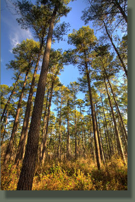
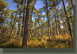
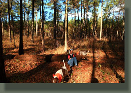
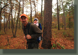
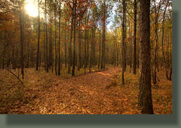
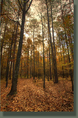
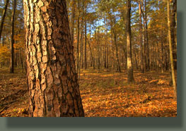
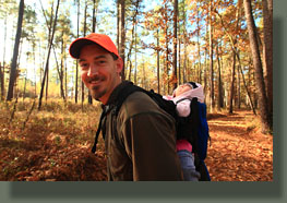
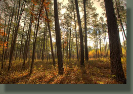
November 28, 2010 It’s a cool, cloudy morning as we load the car with dogs, baby, overnight gear. Leaving Brandon, MS, after our final night of Thanksgiving week vacation, we head east on I-20 to Morton, then down the pine-lined pavement of Hwy 80 to the signed road for the Shockaloe Trail. In the large dirt parking area of Base Camp I, surrounded by huge pines, Andra and I cover Ada with all the warm stuff we have, including using a pair of my socks as leggings for Ada since her socks don’t cover her legs. Nothing says fashion statement like gray athletic socks as thigh-highs. Three other trucks in the parking lot, but nobody around. Henry sniffs the white truck with a dog kennel in back suspiciously. Off we go, into the unknown. I say unknown because research on this trail reveals a disturbingly common phenomenon in internet resources where an entire web page can be devoted to a subject without having any actual information on the subject (I must be careful here not to do the same!). Case in point: Google Shockaloe Trail and you will find, as of this writing, the top 9 hits simply paraphrasing the USFS’s website, some not even bothering to paraphrase and simply repeating it verbatim. One website called maxtrails seems to have a goal of typing the words, “Shockaloe Trail” as many times as possible without regard to content or meaning, while incidentally providing no usable information. Not one of these sites shows any evidence that the author was ever at the trail at all. It’s getting increasingly harder to find information amidst the internet trash, whatever your definition of that may be. The Shockaloe Trail is advertised by the Forest Service as a horse trail, and as such, it is as wide as a dirt road, with sweeping turns over level, forested terrain. It has apparently recently been graded, and the soft, mounded center of the trail is sticky and mushy, making walking a bit difficult. I stop periodically to rub my boots against the rough bark of a pine tree to clear the inches of mud of the soles. We cross a running creek, and both dogs stop to drink: Henry stands in the water while drinking, and Makenzie lays in the water while drinking. The surrounding terrain is flat, with an open understory under huge loblolly pines, with a scattering of red oak, sweetgum and hickory, all leafless. Lots of green briar in here, and Makenzie picks up dozens of briar thorns that I pick out one by one from her short, brown fur. We walk along through the brisk morning chill of around 40 degrees, enjoying the fall ambience. Well, anyway Andra and I enjoy the ambience while Ada sleeps deeply, head thrown back and mouth gaping wide open. Makenzie and Henry, decked out in orange bandanas, race ahead of us, then race back each time I whistle. There’s no medium pace with those dogs. The sun comes out as the fog layer overhead dissipates, and warm sunlight streams in horizontally through the trees from the southeast. A trail rushes by 200 yards from the trail on tracks that are invisible from the trail. Once it’s passed, the silence it leaves behind seems even deeper than before. We continue on. The trail is predictable, and the scenery, though pleasant, is fairly static. I’ve no idea if all 23 miles of the trail is this way, but I imagine most of it is. The Forest Service, with characteristic directness, summarizes the trail’s principle attribute in this glamorous way: “A trip along the trail allows the rider or hiker to view more than 60 years of forest management practices in the area.” Ooooh. Forest management viewing op! Awesome. Sign me up. Well, at any rate the claim doesn’t lie: we see from the trail the boundary where a clearcut has grown up with pine trees thick as wheat. The real appeal of this trail seems to be a tour of a large block of relatively intact southern pine forest that, a quick look at any map will reveal, is pretty rare. Mississippi is so carved up into towns, farms, chicken factories and timber plantations that even small national forest areas are rare. Such is the price of progress. After about an hour of walking
away from the car, we turn around and head back. A beagle appears out of
nowhere and takes up with us, hiking alongside our dogs, peeing where they
pee, all the way back to the parking area, where only two trucks remain.
I call the number on the dog’s collar and leave a voicemail for the owner,
who shows up in the white truck with the kennel in the back a few minutes
later to retrieve his errant hunting dog. We load up our gear, and head
on down the road for Tennessee.
|
|
