
| Location: Medicine Bow National
Forest, WY
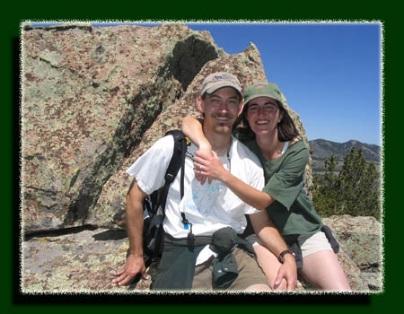
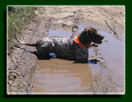
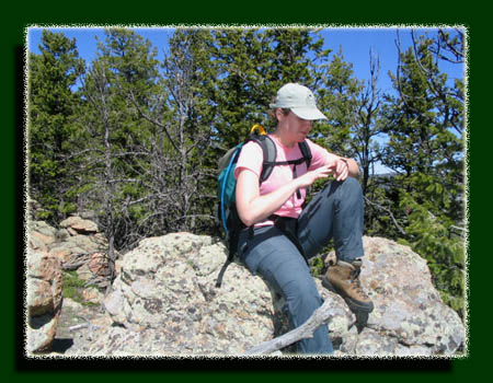
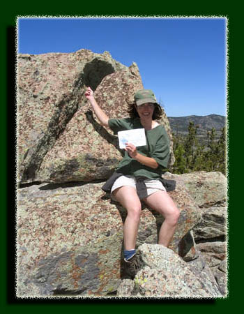
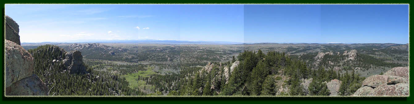
Maps: USGS 7.5 quads: Sherman Mountains East, Sherman Mountains West Access: Go east on I-80 from Laramie 10 miles, then exit and go east on Happy Jack Rd about 6 miles. Several well-maintained gravel roads lead south into the area. There are few established trails. Trailhead: Since there are no trails to the summit, you can park any number of places. I'll suggest parking at NAD83 z13 469453e 4560671n Elev: 8360' Dogs: Voice control Fees: None Webcam: Vedauwoo Exit cam (4 miles south) Weather: Current conditions Local Forecast ------------------- May 21, 2005 On a bright summers morning, Christine, Andra, Frank, Makenzie and I all piled into the car and drove 30 minutes west under a nice blue sky towards Vedauwoo, which is a forested region lying just north of Interstate 80 between Cheyenne and Laramie (closer to Laramie). The area is part of the Medicine Bow National Forest, albeit a relatively small chunk of it, but is a super place to go hike when there is no time or motivation to drive the 1.5 hours up to the Snowy Range west of Laramie. The benefit of living near mountains must be taken advantage of. The Sherman Mountains, a small range, stretch across an area that is littered with blocks of granite. Giant odd-shaped rocks dot the plains between the sharp ridges, some stacked on top of one another to form massive formations. I hear it is a great place to go climbing, but I am not in search of such high-adrenaline activities. After 30 minutes driving west on WY210, I turned south onto an unlabeled dirt road just west of the Vedauwoo Rd and drove another couple of miles on the rough grade until we all agreed the low-riding Saturn should go no further. I pulled the car off the road onto a grassy flat. The dogs spilled out of the car like wriggling worms when the car doors opened, and we spilled out after them into a warm, calm summer morning. As the dogs sniffed around with wagging tails, we loaded water and snacks into our packs and locked the car. Then we were all off, up the dirt road towards our destination Sherman Mt, the tallest mountain between Laramie and Cheyenne (everything needs marquee billing). Sherman Mt summits at 8841, and just east of it lies Green Mt, almost as tall. Together, these comprise the Twin Mt. All of this information is taken from the 1987 USGS quad map. I have never seen anything called Pole Mt on any map or publication, but for some reason, this forest unit is called the Pole Mt unit. I have never figured out why. Really, I guess it doesnt matter much. The first part of the hike followed the road, which was easy enough to follow, and generally flat and pleasant. Short aspen lined parts of the road, and beyond that lay grassland dotted with sagebrush, broken by patches of ponderosa pine. Makenzie quickly overheated and splashed about in the muddy puddles in the tire ruts to cool off. Dirty dog. We took a left fork uphill into deeper woods, and this led to a round clearing that is evidently heavily-used for camping. It struck a bell with me that I had been here before, only the last time I had hiked here it was through deep snow, and the place looked much different. The trees got thicker as we walked uphill from the clearing, and in some places the going was slow in order to successfully navigate the labyrinth of downed logs and boulders. The dogs were furiously scouting ahead of us for anything interesting to chase/eat/roll in. After taking several dead-end routes that were hopelessly blocked by large boulders or downed logs, we finally made it to the top of this sub-peak of Sherman Mt. The top was barren and allowed a refreshing break out of the thick forest and a good look around to get bearings. We could see that Sherman Mt was only a short walk to the southeast. We walked downhill to the saddle and then started up the west side of Sherman Mt. The going was much like before, tangled undergrowth and boulders in a dense lodgepole pine forest. The summit of Sherman Mt was also bare rock, and we were able to break out into the open to have a look around. Because of the convoluted rock, it was impossible to get to the tip top of the mountain, but we were able to ascend high enough to see the USGS marker embedded in the granite. We stopped and had a snack at this point, and I consulted the map to identify surrounding landmarks. The sun was shining still, and the air was warm. All in all, a great day for hiking. We descended the south slop of the mountain to shake things up a little,
and then hiked east to Crow Creek to give the dogs a little water. From
there it was a short walk back to the car.
|
View Larger Map 
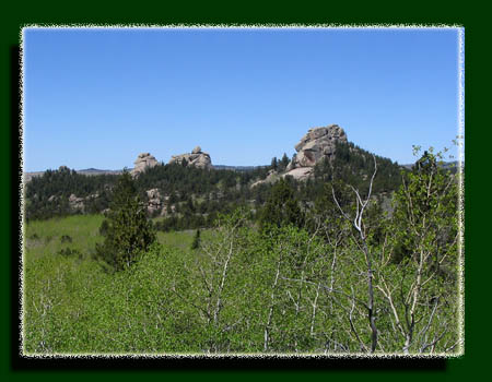
Brady Rock to the southwest of Sherman Mountain. |
|
|
|
|
|
|
|
|
| Page Created 7-28-06
Comments |