| Location:
Snowy Range, Medicine Bow National Forest, west of Laramie, WY
Maps: USGS quad Medicine Bow Peak (Tipple Trail is not shown) Access: From Laramie, head south on the Snowy Range Road (Hwy 130) to Centennial, and continue for 14 miles to the West Lake Marie Trailhead. Cross the highway to access the trail. Trailhead: NAD83 zone13 389129e 4576363n Elev: 10,480' Trail: From Lake Marie to the Miners Cabin trailhead and back is 4.9 miles, takes ~2 hours. Elevation gain =500 ft Dogs: Voice control Webcam: Arlington Interchange, 30 miles north Weather: Current & Recent Conditions Snow conditions NWS Forecast
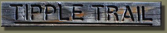
August 22, 2008 Its late August at 11,000 feet, which means its fall. Smoke from fires burning to the west has drifted with the wind, and obscures the horizon. Normally I can see the Mummy Range clearly from here, but not today, and only a vague hazy outline distinguishes the Rawahs. Another few weeks and the air will clear to that crystalline blue fall sky, but it is still summer down there somewhere. Up here, the cool winds of fall are blowing. The columbines and delphinium seeds heads are ripe, dry and open, scattering seeds with each gust of wind from the west. The sedges in the meadows are yellow and dry. Grasses, likewise, yellow. Its only a couple of weeks before the willows and aspen will start to hint their fall color. At 8:15 we arrive at the West Lake Marie Trailhead parking area. Although the sky is clear of clouds and the sun is shining gamely, I am glad I wore pants as I step out of the car into 50-degree, 20 mph wind gusts. I throw on my long sleeve shirt, and then my pack. Makenzie, canis familiaris, waits in the backseat. I open the door and she bounds out, exuberant. Shes a pretty energetic dog anyway, as pointers are apt to be, but cold weather sets her into a frenzy. We cross the lonely parking lot, cross Hwy 130, and set off up the trail along French Creek, roaring in its quartzite-boulder canyon below. The darkness of the dense spruce forest swallows up sunlight, and I have to ramp up the ISO on my camera to 1600 to get a shot at F4.0. We head east through the forest, catching occasional glimpses of the impressive Snowy Range through the trees to the west. The trail breaks out onto a cliff above French Creek, and I stop for a moment to enjoy the view, the silence, the gravity of the scene. Pictures show what it looks like, but they are a poor substitute for the experience. You must stand in the stillness of the conifers, smell the tree sap, hear the rush of the cold water on rocks and feel the thin, icy air blow across permanent snowfields to really get the taste. The trail is well-made, and well-trod, offering no question about its direction. On such a path my mind always wanders, and I wile away countless footsteps lost in thought. We reach a fork in the trail, and head towards the Miners Cabin, away from the French Creek trail. The path descends, crosses French Creek with a good bridge, then rises again out of the canyon and towards the north through more dense spruce trees. Despite the lateness of the season, some flowers are still in bloom. Yellow asters and purple daisies, some call them aspen daisies, are still throwing color about in the meadows and clearings in the woods. I cant name all the flowers off the top of my head and that surprises some people who know my degree is in botany. Generally, people equate botanists with people who can name any plant on sight in Latin. This is probably the Hollywood effect, but it is not reality. Would you expect a marine biologist to be able to name every creature in the ocean? A zoologist to name every rodent encountered? There are many facets of botany that have nothing to do with naming plants. What about photosynthesis, secondary metabolites, water potential, cellular respiration, growth hormones, pollination mechanisms, reproduction and angiosperm evolution, to name a few? In fact, there is a specific specialization in botany called systematics that deals soley with the naming and classifying of plants, and I actually find it pretty boring. As Edward Abbey once said, and I paraphrase, What it is no man knows, but it is called a . In other words, the name of it isnt really all that important. Knowing that the flowers require insect pollinators, and that the stomata in the leaves let in carbon dioxide, which combines with water in the presence of sunlight in the process of photosynthesis that creates carbohydrates for use in metabolism is infinitely of more interest. But I digress from the hike at hand. I follow Makenzie as she parades happily through the dappled sunlight, and we break out of the trees after about 35 minutes of walking into a sun-flooded meadow with giant posts and cairns for trail markers. The path is faint, indicating less traffic up here, and lonely. We have not passed any people, nor seen signs of recent use. As before, through the trees, as if sneaking glances on our progress, are the silver broadsides of the Snowy Range. I stop to snap pictures, adjusting the aperture radically to account for the intense reflectivity of the quartzite peaks. Easily 1.5 stops compensation is required to avoid washout, and even then, sometimes The trail leads us to the front door of a squat old cabin used by Miners who operated the nearby mine. I inspect the shack for signs of homely comfort and find none. Even accounting for the debilitating passage of time, this place must have been a miserable spot to stay for any length of time. The door is but 5 feet high, and the planks of wood serving as bunks also appear to be only about 5 feet long. The entire cabin is only about 12 x 10 feet, and by the presence of a picnic table and benches bolted inside, I surmise that this one room served as bedroom, living room and kitchen. Luckily the outside accommodations are pretty comfortable, at least in summer, and time spent laying about in the woods wouldnt be time wasted. At this point the Miners Cabin loop trail intersects the Tipple Trail, so we opt to take the right fork of the loop trail, which is only 6/10 of a mile. The trail heads uphill towards another trailhead on Hwy 130, with small interpretive signs along the way. I glance at a few signs, recognize them as copies of a thousand other interpretive signs Ive read before and keep walking. The only one I stop to read is the sign situated in front of the old mine, which describes what youre looking at. Its not at all clear exactly what it is. Turns out its the remains of the mine tower and boiler, presumably used to power the wench that hauled out the ore. The sign reveals, disappointingly, that very little precious metal was ever extracted from this location. Makenzie and I head downhill towards the cabin, pass it, then begin to retrace our steps along the Tipple Trail just a little over an hour after starting out. Back in the shelter of the spruces, I feel pretty warm, so I shed my long sleeve shirt and suck down some water. We cross several small streams before again reaching French Creek, where I take some time to sit and enjoy the cascading water and yellow flowers on the banks. Its a beautiful spot. We reach the parking lot at 10:15, making our round trip in about 2 hours. Makenzie seems pretty tired, but we make the short walk to Lake Marie anyway, and I snap a few photographs of this incredibly photogenic lake and mountain range. Beautiful spot.
|
;)
;)
;)
;)
;)
;)
;)
;)
;)
;)
;)
;)
;) |
 Page created 8-22-08 Comments |
;)
;)
;)
;)
;)