| Location: Wild Basin,
Rocky Mt National Park
Access: From Lyons, drive north on Hwy 7 through Allens Park, and continue north 3 miles to the Wild Basin Entrance Station on the west side of the road, right across from the Wild Basin Lodge. From Estes Park, drive south on Hwy 7 13 miles to the Wild Basin Entrance Station. Youíll pay an entrance fee and then drive 2 miles to the end of the road and a small parking lot. Trailhead: NAD83 z13 451799e 4450972n Elev: 8520' Trails: All well-maintained and marked, typically through heavy conifer forest. One-way distances: To Thunder Lake: 5.5 mi with 2,100 ft gain; To Bluebird Lake: 5.6 mi with 2,500 ft gain; To Pear Lake: 6.3 mi with 2,100 ft gain. Some trails can be combined for mileage savings. Many additional lakes lie beyond these main lakes. Maps: USGS 1: 24,000 quadrangles: Allens Park, Isolation Peak Fees: $20 week pass ($35 annual pass) + $20 backcountry permit if camping Dogs: Not allowed (the biggest failing of the National Park Service plan) Webcam: 10 miles north in Estes Park Weather: Current and recent conditions Local forecast
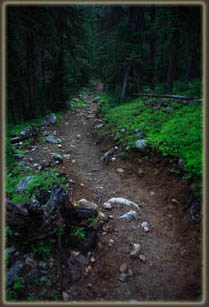
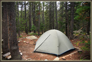
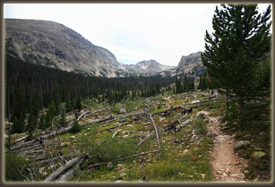
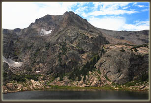
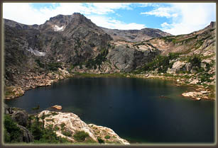
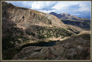
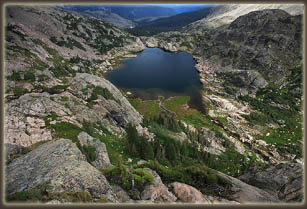
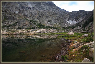
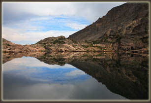
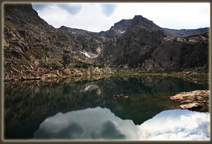
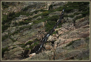
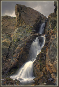
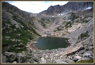
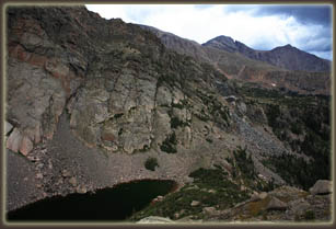
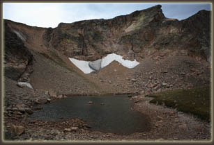
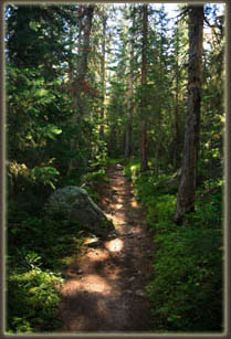
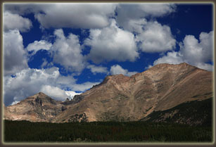
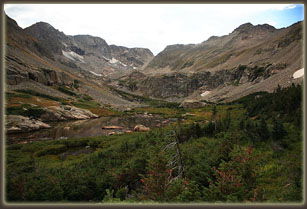
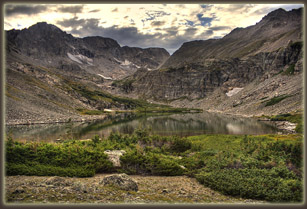
August 31, 2007 The remorse of a summer winding down without a big backpack trip in the Rockies set in furiously on the last Thursday of August 2007, and I decided spuriously to ditch work on the morrow and take flight to the hills. I had tentatively planned a trip to Wild Basin in Rocky Mountain the winter before, and the trip outline had languished in my trip spiral for months. Dusting it off, I found I had planned a 5-day trip. I pared it down to a 4-day outline, and knew that my chances of just showing up at the backcountry office and getting my first pick of campsites was low anyway. I threw some gear together, and went to bed late. Next morning, I was out of the house by 7AM, driving south from Cheyenne to Estes Park on a beautiful, sunny morning. The dogs had given me dirty looks when I shut the back door carrying my backpack, but the poor canine troopers are verboten in hinterlands of the park, so they had to stay. Arriving at the backcountry office at 9, I walked inside and started perusing the list of available backcountry sites. Most were taken. It was Labor Day weekend, afterall. Still, a few were open, and though they were not my first choices, I took them since I had no choice. I hopped in my car and drove south to Wild Basin, parked the car, and as quickly as I could, hopped on the trail with enthusiasm. It was 10:15 in the morning. I was struck by the license plates in the parking lot: Nebraska, Wyoming, California, Michigan, Kentucky, Florida. Folks travel from all over to come here, and I am lucky enough to just hop in the car and be hiking three hours later in Rocky Mt, a place most people get to once, at best. Lots of people were on the trail, and I spaced myself between them to delude myself into thinking I was all alone. Not only is the forest more peaceful when there are no other bipeds about, but I can sink into that deep-thought trance that allows the miles to just float by underfoot, without care. Dodging folks on the trail breaks that up, and makes the trail seem longer. Not that I minded the trail. It was beautiful, as most trails in the park are. I walked the Thunder Lake trail starting at that Ranger Station and followed North St Vrain Creek for 2 miles before branching off for the campsite access trail that led north of the creek while the main trail led south of the creek to Calypso Cascades and Ouzel Falls, the primary destination for most dayhikers, I gathered. Once I was on the narrow access trail, I felt much more alone. I parked my keester a few feet off the rocky trail and gulped some water while drying my sweat with a handkerchief. I passed several of the backcountry camps: Pine Ridge, Tahosa, Siskin, before coming to the North St Vrain camp at 11:45, which is at the junction of the camp access trail and Thunder Lake Trail, just as it crosses North St Vrain Creek. I pitched my tent in one of the two tent pads and hung my food on the bear line. My shirt was soaked with sweat so I hung it in the sun and lounged around for awhile waiting for it to dry. By 12:45, I was ready to go. With my pack reduced to bare essentials, I headed off downstream on the Thunder Lake Trail 0.4 miles to the junction with the Bluebird Lake Trail, and huffed and puffed up the initial steep grade to the open ridgeline that burned in the 1978 Ouzel Fire. Through gnarled snags, Longís Peak and Mt Meeker rose up on the northern horizon. With the forest cover largely gone, views in all directions were outstanding. Unfortunately it was getting cloudy, and the skies were turning gray on me. I continued along the ridge, following the trail which slowly bent westerly and gained elevation gradually. Raspberries along the trail provided nice snacks, though were so small that it took half a dozen to make a bite-sized tidbit. After reaching the Bluebird Lake backcountry camp, the trail really shot upwards, and the going was slow through the cloudy, humid air. This was the toughest part of the hike. Once I made it to the lake, I sat down and rested, enjoying the view of the large alpine lake surrounded by cliffs and mountains. Copeland Mt sat on the left, Ouzel Peak in the center, and Mahana Peak on the right. The shoreline was alternately rocky and lush with grasses, mosses and raspberries. I didnít see anyone else about. After resting, I decided to head uphill, and made a route up towards the ridge that separates Junco Lake from Bluebird Lake, which I reached after an hourís tough climbing up a steep slope that often required me to use my hands to help pull myself up steep passages. Junco Lake was a smooth glass pool of water inside a barren, rocky bowl. I didnít tary long there, but instead headed west across a tricky boulder field in the shadow of Ouzel Peak to a ridge overlooking Bluebird Lake. The boulder fields always make me tense, and I find the best way to take them is not to look around too much, but to just take it carefully rock by rock. Great views of Bluebird and Pipit Lakes awaited at firm ground beyond the rockfield. I was now at around 12,000 ft. I loafed and snacked on a particularly comfortable rock from this perch. Continuing west over rough terrain, and getting cliffed out a few times and retreating, I headed over to the shore of Pipit Lake, another largely barren lake. I donít know why I feel these urges to visit all the lakes in a basin, but it is very satisfying. I contemplated hiking uphill to the tarn of Isolation Lake, but it was getting late, and the clouds were getting thicker. Plus, I was deliciously tired. Following the outflow from Pipit Lake, I walked past Lark Pond, a very shallow pool, and then followed that outflow across a wide and rock-strewn delta down a very steep incline about 100 meters to a waterfall. I stopped to photograph it, and shortly thereafter the rain came. I was near an overhanging cliff, so I simply moved under the shelter of that and waited 10 minutes for the rain to pass. Once the moisture stopped, I continued down to the north shore of Bluebird Lake, and around the north side of the lake over to the trail, completing a nice loop around the lake in about 2.5 hours. Still lucking out on the lack of major rain, I began the hike downhill back towards camp. I hiked quickly, but couldnít resist stopping for raspberries again and again. About 1.5 hours later, I arrived at camp. Within minutes, the heavy rains came. I cooked my dinner in the relative shelter of a large spruce tree, then climbed into my tent and read a book until dark and bedtime.
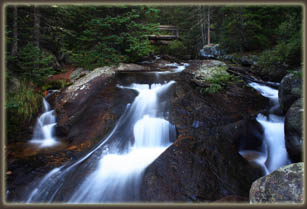
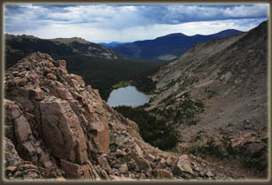
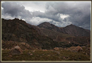
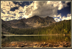
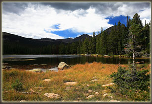
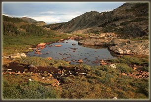
September 1, 2007 My watch alarm beeped in the darkness at 5:30. I woke up in my lovely, warm down sleeping bag feeling petrified with fatigue from the previous day hike up to Bluebird Lake. I lay awake in the still silence of pre-dawn with only my face exposed to the frigid morning air, and debated getting a nice, early start and maybe catching a good sunrise. My sleeping bag felt so incredibly warm that I was persuaded to simply drift off to sleep again. Turned out that was probably for the best since when I awoke again at 7:30 and peered out of the tent, the sky was an unbroken slate gray cloudbank. I reluctantly threw on my cold clothes and packed up camp. With that done, I retrieved my food from the bear line and ate a breakfast of Chex and dried mango, eating slowly and deliberately on the bank of North St Vrain Creek, near the waterfall that cascades below the bridge at the backcountry camp trail junction. By 8:30 I was ready to go, and began to hike up the trail towards Thunder Lake. The day warmed up quickly, even with cloud cover, and before long I had a nice steady sweat going as I plodded up the trail with my leaden pack. No matter how you try to economize weight, my pack always feels like lead on those uphill trails. The trail was silent, and nobody was out and about except for me. Ranks of spruce and fir passed by on either side of me, their gray trunks marching outwards from the trail in both directions for as far as I could see. I dropped into the zone, that hiker zone where the mind goes someplace else and chills for awhile as the legs do the dirty work. Itís the best way to get past those rough, uphill, first-thing-in-the-morning sections, I find. I stopped once, to take off my sweatshirt, and around 11:00, I rolled into the Thunder Lake backcountry camp. There are 2 backcountry campsites and 1 group site at Thunder Lake, and Mr Park Ranger frowns on those who donít abide by the rules and camp in the designated area. My choice of camping areas was thus made easy: Site 1 was taken and I donít qualify as a group. I set up my tent and stowed my food in the metal ammo can that bears seem to agree is not worth fucking with. Under cloudy sky, I set off to the lake with only bare essentials in my backpack. Like most alpine lakes, Thunder Lake sits in a bowl of rock roughly carved out by glacial movement. At least, thatís what Iíve been told. I wonít attest personally to that. Itís a big lake, and is fed by several streams that run down through meadows and falls from smaller lakes and ponds higher up. Thunder Lake is surrounded by lush firs and spruces, and several dense thickets of willows near the inlets and outlets. Higher up the slopes are barren rock, and highest on the horizon sits the Continental Divide and the 12,000-ft Boulder-Grand Pass. I hiked around the north side of the lake on a well-worn path. At the west side of the lake, I broke away from the trail and followed a small stream uphill in a northerly direction to Fan Falls, a wide and shallow cascade that emerges from the mountain some way above a flower-filled meadow. There were a few steep spots to get up to it, but the view from the side of the falls was grand. The sun came out, blue skies reigned and all was well. Fan Falls is fed by what appears from the map to be a pond a little higher up. I skipped it. I carefully crossed the falls, which was pretty tricky with all the moss-covered rocks, and slowly picked my way sidehill across a 1,500-ft boulderfield. Those boulderfields weird me out a little, Iíll admit. Thereís no terrain Iíd rather not hike across, but sometimes you just have to. I went slowly, avoiding walking downhill of large boulders while imagining a Stephen King-like ending to my life, freezing at 12,000 ft with my leg stuck under a dislodged rock the size of a Volkswagen. The sky had turned ashen gray by this point, and I was anxious to get off the rocks before the rain that was obviously coming finally came. I was pleased to get back to tundra. When I did, I was on a ridge that allowed a view down to Falcon Lake, a shallow basin of rocks with water in the middle. Timberline-stunted firs formed green pockets around the lake. A boulder the size of a house sits at the outlet, and I arrived there just in time to make use of it as a rain shelter. Lucky timing. Also lucky was the prominent lack of thunder. Rain I can handle. Lightening, well, I might just spend the night under this rock here. As the rain abated, I could hear the sound of a waterfall not far downhill, so I picked my way through stiff, dwarfed fir trees to what Iíll call Falcon Falls, where yellow and purple daisies had taken all the front-row seats. I took in the view, and then decided to hop the ridge to the south and get to the exotically-named Lake of Many Winds. The hiking up was technically easy, but very steep and I was huffing and puffing before long, taking short breaks every 20 steps to catch my breath. The sky was still very disturbed, with roiling clouds overhead, but still no thunder. Still, I wasnít in the mood to tarry, so I pushed it to the top. Looking over my shoulder, Longs Peak and Mt Meeker came into view, their summits looking most uninviting against the cloudy sky. The ridgeline between the two lakes has an east-west axis, with the eastern side rising to a point of ~11,600 ft before dropping off precipitously to Thunder Lake. I wanted to get to that point, but it would be a very exposed position with the only escape back along the ridge, in the direction from which thunderstorms would be coming (if they were coming). I decided not to take that risk, and instead headed straight downhill for Lake of Many Winds, a leaden, ice-rimmed pool of clear water without any green in sight. Under the foreboding gray sky, the place could not have been less cheerful. The lake was well-christened, I can say that. A torrent of wind swept over the Boulder-Grand Pass, fiercely pressing on my back as I walked towards the outlet. At the outlet, I picked up a faint trail that lead steeply down, loose gravel treacherously sliding underneath my vibram soles. I picked my way carefully down the slope into the open basin below, instantly enjoying the sudden relaxation of the wind as I descended below the basin rim. The faint trail entered the trees below and lead to the western shore of Thunder Lake. Seeking to complete a circle around the lake, I left the trail that lead easily back to camp and instead took off through tall grass around the southern shore. Rockfields and swampy patches confounded me, but I eventually made it around to the outlet, and back to the trail. As I arrived, three hikers peeled off their outer clothes and ran pell-mell into the lake, completely submerging themselves about 30 feet offshore. Cold which I cannot imagine elicited panicked gasps and shouts as they fled back to shore. I walked back to camp to find a man and his 9-year old son had pitched their tent right next to mine. I learned through casual conversation with him that he had no idea about backcountry reservations, or really backpacking in general. He was hopelessly over-geared with tons of crap that REI has somehow convinced the masses they must have on overnight trips. I had to give him credit though for getting out and getting his little guy all the way up to Thunder Lake, and though I really hate to camp close to other hikers, and resent even the modest distances the Park Service puts between designated camps, I didnít consider telling him to move on. I was tired from my hike, so I laid down in my tent, but the man and his son were very chatty, and I soon left grabbed my book, left the tent and walked deep into the woods and found a quiet place to hang out and pass the afternoon away. As dusk approached, I returned to camp, cooked a quick meal, and washed my socks in water I pulled from the stream. I tried to go to bed early, but my neighbor talked incessently. My patience was further eroded during the night with his constant snoring. Its amazing how loud snoring can seem in the woods at night in the calm air of 10,000 ft. Seriously, next time Iím moving camp deeper into the woods, rules or no.
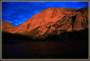
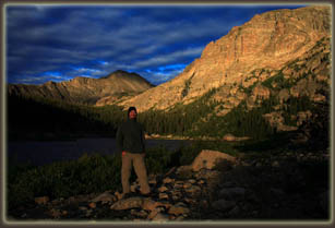
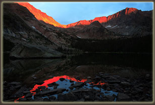
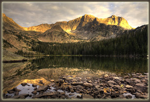
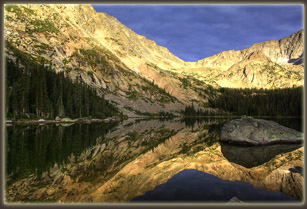
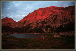
September 2, 2007 After a night of fitful sleep, I got up as soon as it began to turn light out, which was around 6:00. I dressed, grabbed my camera and walked down towards the lake. In the gray half-light of dawn it took me a few seconds to figure out what the heck I was seeing on the trail. Some small animals, moving oddly and jerkily. Turned out to be about 6 ptarmigans, walking across the trail like chickens. A deer watched me from ten feet off the trail, never moving as I passed by. I got to the shore of the lake, where not a ripple stirred on its glassy surface. Under ragged clouds, I set up my tripod and waited, hoping for a sunrise. It came around 6:30, when for 10 minutes the sun peeked under the expansive layer of clouds in the east and sent a subdued, orange light flooding onto the upper peaks. Soon that faded into a dull white light as a cloudbank scuttled into the way. I waited longer, quietly watching the light change on the bare rock of the mountains. An osprey appeared on the far side of lake, flapping slowly, lazily, dropping towards the water and with a splash struck its talons in the water, and came up with a wriggling trout. It held the fish so that its head faced forward, not sideways. Iíve heard that is typical of ospreys. I could see how it held the fish because it flew about 20 feet over my head on its way to breakfast. At 7:15, the sun came through again, more yellow this time, lighting primarily the lake and surrounding trees, but not shining much on the upper peaks, giving them a sullen, distant look. One other fellow came down from camp around this time to photograph the sunrise, and we talked a little in that quiet, mountain-morning way. The second show ended around 7:30, this time apparently for good, so I hauled back to camp, ate a cold breakfast, packed up camp, and was on the trail by 8:20. I hiked briskly down the steep trail, which put me pretty far away from Thunder Lake by 9:00 when the clouds quickly dissipated and sent brilliant sunshine flooding into the basin. I considered going back, as I never really felt like I got a good, sunny photo of Thunder Lake, but the distance was too far, so I continued on. Around 10:00 I arrived at Ouzel Falls, where lots of people were gathered on a bridge watching the water. I set my pack down and walked up a little patch to the east of Ouzel Creek to a higher point where the view of the falls was much better. Itís a nice cascade, and I quickly learned that this is the major destination of hikers in Wild Basin. I continued on the trail to Calypso Falls on Cony Creek, which is a wide, shallow falls. The trail forks around this area, with one route heading back towards the parking lot, and the other heading uphill along the northern foot of Meadow Mountain. This trail gained elevation and afforded nice views of Longs Peak to the south, especially as it passed through a portion of the Ouzel Burn where the pine trees were burned away and views were virtually unimpeded. At a junction, I turned south towards Finch Lake, and hiked about a quarter mile before taking a snack break at 11:00 in the shade of the lodgepoles. This section of the trail obviously sees much less use than most others, as it is narrower and rockier. Watch your step! After about 20 minutes of lounging and letting the sweat dry off my back, I got back to it, heading steadily uphill, then downhill, then uphill, then downhill. It really is a sadistic trail. It takes you to about 10,200 ft before dropping you down to 9,900 at Finch Lake. Being a long hiking day, at around 9.5 miles and lots of elevation change, I began to get really tired by the time the trail dipped down to Finch Lake, a swampy looking pond rimmed with cattails. It clouded up quickly, and rain definitely felt imminent. I really wanted to make it to camp before it rained, but I didnít. When the first wave hit, I took shelter beneath an overhanging rock for about 15 minutes until it tapered off, then I slogged uphill in a light rain for the last mile or so. Thunder boomed overhead, but I felt safe in the trees. Upon arriving at Pear Lake, I missed the sign showing where the camp was (itís not obvious over there on the west side of the lake), and took a trail that continued along the east side of the lake. As the trail deteriorated to little more than a game trail, I became convinced I was in error, but the rain was strengthening, and I was super anxious to get my tent up before everything was soaked. I was on the verge of setting up camp right off the trail when a couple came heading down the trail at a brisk and worried pace, glancing up every time the thunder crackled overhead. I asked them if the designated camp was up ahead. The man said no, but told me where to go back to and find it. I obliged, hurriedly following them down the trail, and splitting off to cross the outlet creek to the camp area. I put my tent up in record time, under heavy rain with lightening streaking the sky overhead. If not for the abundant trees all around, I wouldnít have even been there. With the tent up and my hands chilled to the bone, I crawled inside the tent, then inside my sleeping bag without even removing my clothes, and fell asleep in seconds. I slept for about an hour, and got up at 3:00. It was still raining, but the thunder had abated. I was cold. Everything was damp, and the salt that had built up on my skin over the last 3 days of hiking seemed to suck in the moisture, keeping me cold and clammy. A hot shower has rarely sounded so good. It had rained so hard that the tentís rainfly was leaking, and I had to rearrange to keep my bag from getting soaked from the steady drip. I read about Harry Potterís latest adventures while it rained outside, periodically switching hands that held the book to keep them warm. Studying the map, I saw that the only trail in Wild Basin I wasnít likely to get to by the time I left was the spur trail up to Lion Lake No 1. By 3:30 the rain stopped, and I got out of the tent and had a late lunch/early dinner of ramen noodles and crackers. Pear Lake has only a single designated campsite, and I was thrilled to have my own uninterrupted space, especially after my experience at Thunder Lake. Itís not that I dislike people. Some of my best friends are people. Itís just that if I wanted to hang with other bipeds, Iíd go to the mall, or Starbuckís, or work. Out here I want to be alone with my own thoughts, with nothing but my own voice to listen to. The sun came out, and things warmed up quick. Feeling my oats from the nap and the meal, I decided to go see where the trail continued to on the eastern shore. I started around 4:45, and followed the trail through dense woods to Hutcheson Lakes, where the trail pretty much disappeared and I was left to navigate a labyrinth of boulders, impenetrable krumholtz and swamp to get from lake to lake. Copeland Mt loomed up beside me, steep and massive, with high, precipitous cliffs devoid of vegetation. I picked my way slowly towards Cony Lake, and came within sight of it ( or at least the chunk of rock that held it in place) at around 11,200 ft, but it was far enough away that I didnít think I could make it there and back to camp before dark. I really wanted to. I could feel it pulling me closer, that itch to get there, to see it. Why? Ask Edmund Hillary. Even though I had brought my headlamp, the trail I had used to get to this point was faint enough in places that even in broad daylight it was barely visible. It is also well known that bears are not at all afraid of humans in Wild Basin, and I surmised it best not to run into one at all, let alone after dark. I turned back and, after losing the trail completely for about 20 minutes, managed to make it to camp some time after sunset, completing what I figure is about a 3.5-mile loop. I filtered water, and heated some up. In the darkness near camp, I used the warm water and my bandana to give myself a sponge bath. I was determined to get rid of that hydrophilic, clammy layer of salt that covered me. I did, and felt great afterward, though it was mighty cold drying off in the cold breeze. As the warm flame of my camp stove died out, and the darkness descended, I had a sudden rush of my own insignificance in the face of the wide world. The mountains and trees around me were here before me, and will be here, much unchanged, after Iím gone. Thatís trite, and you hear people say it all the time, but sometimes it hits you square how much itís true. I shook the feeling by climbing into the tent, where I felt big in the little nylon-partitioned space. It was well-dark by 8:15. Summer was winding down and it got dark a little earlier.
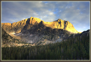
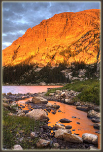
September 3, 2007 My little sponge bath the night before was just the ticket to get a good nightís sleep. That and 14 miles of hiking. Anyway, I woke up around 6 feeling pretty good, ready to get going. I got out of the tent into serious wind, the kind that bows the tent down and stops you dead in your tracks. I picked my way through the boulders down to the edge of the lake and awaited sunrise, my favorite time of day. Clouds overhead, just like the day before, but a little wider gap in the east just right for the sun to shine in. Around 6:30 it did just that, and Copeland Mt across Pear Lake shimmered in golden light as the waves on the lake whipped and snapped. There is ferocious beauty in these hills. You pay your ticket in cramped legs, cold hands and a stiff back, and you sometimes get a great show. This was a great sunrise. Rain came, and the sun rose into the clouds, suddenly cutting off the color. I retreated to my tent intending to nap, but was anxious. That itch to get on the trail hit me, and I packed up camp and hit the trail around 8:30. Clouds blotted out the sun most of the day. These were not summer thunderclouds, but were purely fall rain clouds, so low on the horizon that the higher peaks were hidden from view. Nevertheless, it was warm, and I didnít get rained on. I met two guys on the trail at Finch Lake who had flown in from Wisconsin for a nice long weekend of backpacking and fishing. They were on their way to the airport, in a round-about way. I felt great on that last stretch. The first few days of backpacking, you can get sore and tired, and then it seems that your body spits out all the bad gunk and you hit your stride. That's the way it was that last day. About the time I arrived at the parking lot, this would be around 11:00, the sun came out and shone down on a circus of parked cars. Every spot in the lot was taken, and cars were slowly circling, waiting for an opportunity. As I walked along the dirt road to the car, a minivan drew up slowly beside me. Half expecting a mob hit, an elderly man leaned out and asked me if I was on my way out, and more importantly, could he have my parking spot? I told him fine, but I wasnít going to hurry too much in changing my shirt and shoes before leaving. He seemed delighted nonetheless, and sat patiently with his blinker on and AC on high as I changed clothes at my trunk, loaded my gear, and drove off for home.
|
 |
