| Location:
Roosevelt National Forest, Laramie Mountains, northwest of Livermore, Colorado
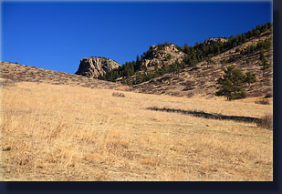
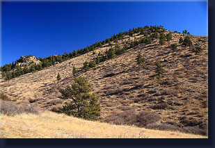
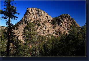
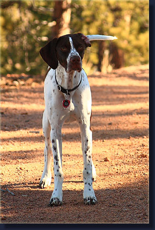
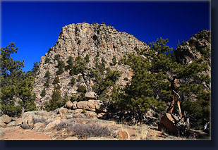
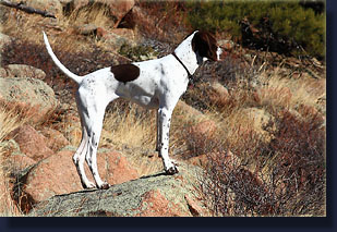
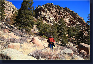
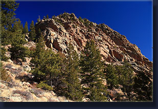
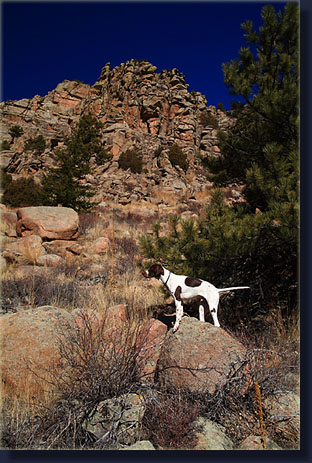
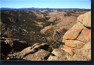
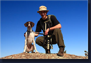
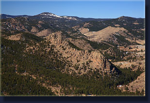
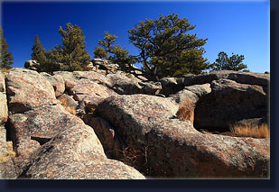
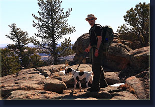
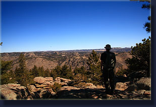
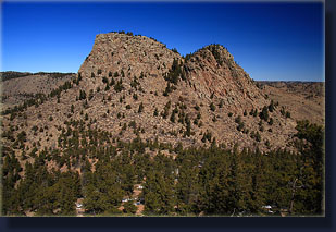
Map: USGS 7.5’ Quad: Cherokee Park // Trail Map Access: From Livermore at Hwy 287 x Red Feather Lakes Rd, head north 3 miles on Hwy 287. Turn west and drive west on Cherokee Park Rd. At 10.7 miles, park at a turnout on the north side of the road labeled Cherokee Park State Wildlife Area or along Cherokee Park Road, for example at 11.9 miles (or 0.5 miles past the Roosevelt National Forest sign). Trail: If you park at the State Wildlife Area parking area, simply follow the road that heads northwest until you are within sight of Turkey Roost. If you park on the road, cross the barbed wire fence onto National Forest land and head north until you intersect the road that leads in from the State land. Either way, leave the road when you are just south of Turkey Roost, cross a shallow saddle and head up the south side of Turkey Roost through boulders and sparse conifers to the saddle. A faint trail guides the way, but it is not too difficult no matter how you choose to head up. Once at the saddle, head west any way that looks appropriate to the summit of Turkey Roost. It is an easy 1.4-mile walk up to the top with an elevation gain of 784’(6950’ to 7734’) from the road. Fees: The signs have no mention of fees, only that the area is closed Sept 1 - May 1 to public access unless you're hunting or fishing. So, if you want to hike the area during this time, pack your fishing rod. Dogs: Must be leashed on State Land.OK off leash on National Forest. Weather: Local Forecast Current snow conditions Snow Graphs March 14, 2009 We arrived at the parking area to the Cherokee Park State Wildlife Area around 9:30. I hopped out of the car to check the map of the area and saw that although this was the spot I intended to be at, I was not aware that a Habitat Stamp was required to enter. I typically wait until later in the spring to purchase my fishing license, so I didn’t have my stamp yet. Not wanting to chance the $60 fine, I remembered that the National Forest boundary was not far up the road, so I hopped back in the car, and Andra drove us another 1.2 miles to a spot along Cherokee Park Rd just south of the National Forest land where no habitat stamp is required to enter. I made a last check of items in the backpack, and threw it on my back. Andra let Henry out of the backseat, where he quickly bounded across the road, necessitating a little leash action until we were well away from car traffic. We walked north and crossed over the barbed wire fence into a large sloping pasture of tawny grass dotted with ponderosa pine. Giant cowpies spoke to the multiple use of this area, and we had a hard time keeping Henry away from them. For some reason, Henry regards cowpies as an exciting delicacy. Disgusting animals, dogs. Within minutes, the summit of Turkey Roost was clearly visible through the opening between the two closest mountains, so we continued to head that way. It was apparent that spring was upon us. The sky was clear blue, the wind was wonderfully absent and the temperature hovered around 45 degrees with promise of warming all day. Within a quarter mile, we encountered the dirt road leading in from the State Wildlife Area just across the section boundary, and followed that up the hill. Henry ran alongside in the grass, or up the hill, or up ahead and back again, bounding around with puppy energy. Invariably, he stepped in cactus, and would stop periodically to lick and chew at this paws. Hopefully he will soon learn how to avoid cactus. The road led us above the grassy fields and into shade thrown by a mixture of Douglas fir and Ponderosa pine. Thin snow banks clung to the shady sides of rocks and the road cut, and Henry scraped up the ice and chewed it up. We came over the rise and Turkey Roost stood before us. We followed the road until it began to bend away from Turkey Roost, then headed downhill to the saddle, and back uphill on the south face of Turkey Roost. The going was steep, but there were plenty of rocks to help keep our footing. A faint trail through the rocks indicated that this route gets some infrequent use. We stopped halfway up and downed some lemonade, took a few moments to enjoy the quiet view to the Mummy Range on the horizon, then continued on into thicker trees. The little path led up to a saddle between two humps, the western one being the higher summit of Turkey Roost. The rough, rounded boulders provided easy grip for boot soles and we picked our way up through the maze of rock and stunted pines towards the summit. Deep bowl grottos and smooth waves of rock sculpted by wind, fire and water created a very interesting geologic experience along the sloping summit. It’s a very cool place. We headed for the south side of the summit, and soon came to a cliff that dropped off abruptly. We stopped here to snack, drink and enjoy the summit. Not a human sound came from anywhere. It was still as a foggy morning with a quietness one rarely experiences on the summit of a mountain. Andra wrapped Henry’s leash to a tree so he wouldn’t take a flying leap into the void and we walked along the south edge of the summit, snapping photographs and checking things out. Halligan Reservoir sparkled to the east, and a jungle of rocky spires and knobs stretched away to the west. The south view was largely taken up by two mountains of roughly equal height to Turkey Roost. After lingering for some time, we headed to the west side of the summit and looked down on the North Fork of the Poudre River and the beautiful valley it flows through. Then we headed down to the saddle. I wasn’t quite ready to call it quits, so I suggested we try to summit the east knob, which was smaller but steeper. Andra decided she’d just guard the pack and Henry while I tried it alone. So I did. The east knob is a much tougher nut to crack than the west due to a cliff band that stretches all along the western and southern faces. I was able to climb up to a ledge by way of a pine tree, but once there it going on up looked pretty steep and, while doable, did not look like lots of fun. More risk that I wanted to take, so I hopped back down to the saddle where Andra and I sat in the sun and threw pine cones for Henry to fetch. He would grab them and roll around in the grass “killing” them. We hiked down to the saddle below, then up a little to the road. Rather than heading right back along the road, we went uphill again along the ridge heading towards the 7655’ peak to the southeast. This turned out to be a good move because the rock formations were very interesting and the ridge provided a nice look back on the stately symmetry of Turkey Roost. We continued south, skirting the summit to the west, and headed down through a forested drainage back to the road, which we followed back to the car. Near the car, Henry refused to continue walking and I had to dig out my First Aid kit and pull out a dozen cactus spines from his back foot with tweezers. We got to the car just shy of 1:00 and he chewed on his foot for a few miles before falling asleep and staying so until we got home. |
 |
 Updated 11-11-13 Comments |