| Location: City of Boulder Open
Space, southwest of Boulder
Map: Trail map; USGS 7.5' Quad Eldorado Springs Access: From Foothills Drive, drive west on Baseline Rd to 9th St and take a left on the first street past 9th, and park immediately in the lot to the west. Trailhead: NAD83 zone 13 475847e 4427662n Elevation: 5696' Trails: There are many, many trails. Grab a trail guide at the TH or check it out here. I took the Chataqua-Mesa loop up to Royal Arch (3.2 miles, round trip, 600' elevation gain to ~6800'). Moderate in places, difficult in winter/early spring because of ice. Dogs: Leash control in some areas, voice control in others if you have a Boulder Sight and Voice tag. Webcam: Flatirons Weather: Current and recent conditions NWS Forecast April 5, 2008
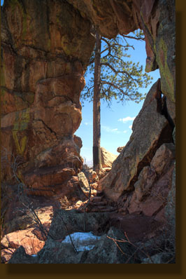
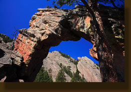
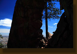
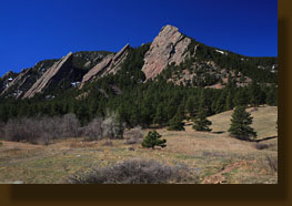
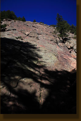
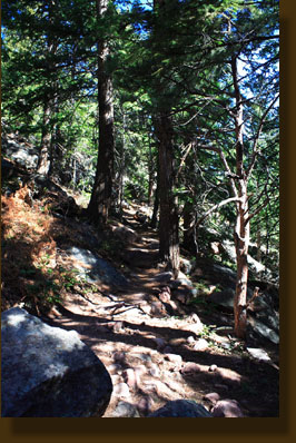
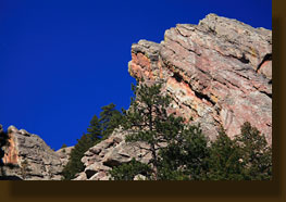
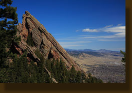
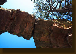
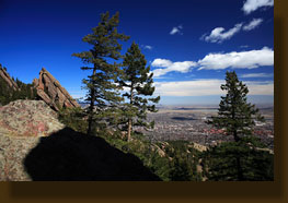
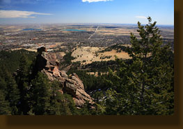
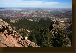
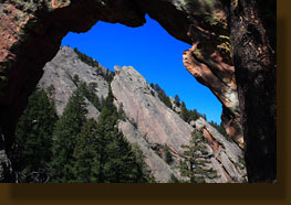
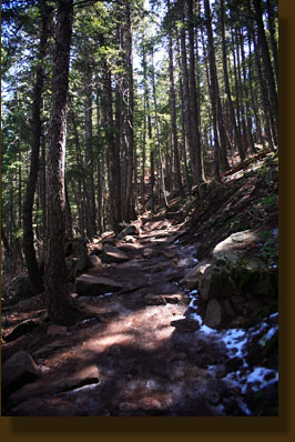
I was glad to see they had trail maps at the TH, for there must be close to 100 trail intersections in the area. Luckily, I found out they were all pretty well labeled. I decided to take the Chautauqua Loop counter-clockwise, with a side trip up to Royal Arch. The first part of the trail was about 8 feet wide, hard-packed and extremely busy. In fact, never outside of a national park had I seen so many hikers. And why not? It's an extraordinarily scenic area just minutes away from anywhere in Boulder, a city of over 100,000. The trail led across an open field with grand views of the Flatirons, then slipped into the ponderosa pines and douglas firs as it continued to wind steadily uphill. I kept a firm idea of where I was and kept my map in hand so I wouldn't miss my turnoff. I passed lots of people on the trail walking slowly, some sitting just off the trail in the dappled sunlight. It was around 50 degrees, but the lack of wind and the intense spring sunlight made it feel like more. I pulled off my flannel and hiked in just my short-sleeve shirt. I took a right turn and followed a beautiful trail into deeper forest and passed by the base of two flatirons, which are tilted blocks of 300-million year-old sandstone and slate that can be seen from 80 miles away. Signs indicated areas of rock-climbing routes, and I can see the appeal. The tilted rock rises up into the sky with all sorts of hand-holds. Getting up seems like a matter of patience. Getting down seems incomprehensible! Thus do I maintain contact with flat ground as I walk on by. I require very little adrenaline to have a fun time. At a final trail junction, I again followed the arrow that points towards Royal Arch. Unlike the early segments of the Chatauqua loop, this trail was largely deserted. It was steep, and heavily shaded on the north side of the mountain ridge. Great stone blocks formed a ceaseless staircase up the mountain, and I sweated and labored in the cool air. After a long winter, it was fantastic to actually feel hot again! Ice lingered on the trail, but a thick layer of frozen mud on top of it provided great traction. Signs to the west of the trail warned against entry from Feb-July due to nesting raptors. I was relieved that the trail never crossed into this area. This section of the trail reached a pinnacle that I anticipated was the end, but instead the trail sloped back downhill and led further south. This section of the trail was in the sun, and largely free of snow, and I cruised along through the pines and douglas firs. As the trail began to ascend again, it iced up suddenly. This time there was no layer of frozen mud, or anything else, to provide traction, and I slipped and skidded as I made my way up the steep grade. I hopped from rock to rock, trying to avoid all contact with the ice, and used my hands as much as I could to grab on and haul myself up. It was tricky, and slow. However, I made it to the arch without falling and I celebrated this minor success with a peanut butter granola bar. The arch was larger than I expected, presenting a hole in the rock some 20 feet tall. A large ponderosa pine grew up just to the south of the opening, and a sloping slab of rock allowed hikers to walk out and peer out on the town of Boulder and the forest below. The views of the plains were fantastic, and I was happy that the sun had continued to shine, despite forecast for snow. I photographed the view, the arch, and waited for quite some time to photograph the entire arch from the north without any people in the view. There was quite a crowd, and this last goal took me about 45 minutes to achieve. No worry. It was warm, sunny, calm and the scenery was spectacular. I bided my time on a rock well away from the arch, sitting unseen by most hikers who came and went. Once I had my shots, I began carefully lowering myself down the trail by crabwalking, using the rocks protruding from the ice as anchors and taking my time. I came upon quite a traffic jam, and had to wait while others carefully inched down the trail. I watched 5 straight hikers wipe out on this section, but I was glad that my technique didn't let me down. Thus, I reached the dry trail without a wet bottom or knees to show for it. The hike back was quick, as it was steeply downhill. I took the east
leg of the Chatauqua loop towards the parking lot. I was tempted to branch
off and take the McClintock-Enchanted Mesa loop back, but a look over my
shoulder showed clouds brewing over the Flatirons, and the predicted snow
seemed to be on its way. I stuck to the Chataqua loop and made it back
to the car, 3 hours after starting off.
|
 |
