Location:
Medicine Bow National Forest, Wyoming
Access: From
Laramie, take I- 80 41 miles to the Arlington exit, then go south under
the interstate, and take the first right on a gravel road that has a sign
reading Medicine Bow National Forest . Drive about 200 yards west on this
access road, and take the first left turn marked by a sign reading Rock
Creek Trail 1.6 miles. Drive down this rough gravel road to the dead end
at the trailhead in 1.6 miles. Road is probably not passable to passenger
cars after heavy precipitation.
Trailhead: NAD83
z13 397448e 4603585n Elevation: 7850'
Maps: USGS 1:24K
Arlington, Morgan, Sand Lake,
White Rock Canyon
Trail: 11 miles
to Sand Lake via Deep Creek Trail, follows the water the entire way. The
part of the trail Ive been on (northern half) is pretty mild uphill with
rocky footing in places through open Douglas fir-spruce forest with sagebrush-grass
meadows. Wildflowers are great in June.
Fees: None
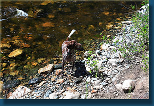
Dogs: OK
Webcam: Arlington
Interchange, 3 miles north
Weather: Conditions
at Lower
Rock Creek and Upper
Rock Creek
Local
Forecast
June 24, 2007
Andra, Frank, Makenzie
and I started this hike at around 10AM on a sunny morning in late June.
The parking lot was shaded and deserted except for a Jeep, and the dogs
sniffed around the area while we pulled on our boots and locked up the
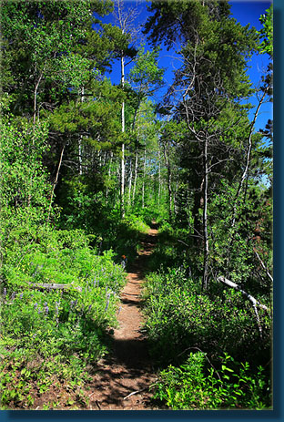
car. The trail headed south from the parking lot behind a large information
board containing information on how to tell if youve been bitten by the
dreaded lyme tick. Large Douglas fir and spruce trees provided a good covering
of welcome shade on this warm morning. Lupines, larkspur and arrowleaf
balsamroot were all just past full bloom along the trailside and in the
surrounding meadows. The path immediately gained quick elevation as we
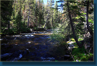
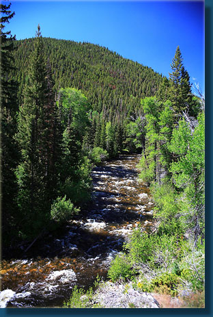
left the sound of the roaring water below. Soon Rock Creek came into view
to the east, below us, rushing wide and white over a rocky bed. I was impressed
by the size of it, and thought it more a river than a creek, though I confess
I dont know the technical requirements for either. Within ¼ mile
the trail leveled out right next to the water, and it took no effort to
compel Frank and Makenzie to drink something, and of course Makenzie enjoyed
a good soak while she was at it. We all strolled along leisurely up the
mild incline, usually very close to the foaming water of Rock Creek, through
patches of hot sunlight in dry meadows and under patches of thick conifers.
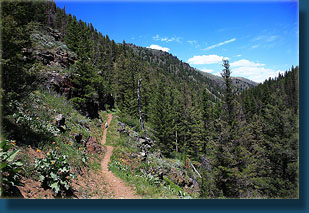
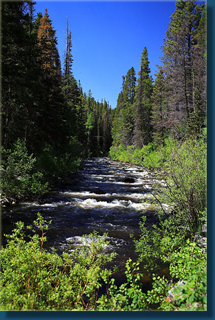
We passed several flat campsites near the water, but all were pretty close
to the trail. The canyon in which Rock Creek flows is too steep and narrow
to get far off the trail. Just before the first switchback in the trail,
we stopped in the shade and had a snack, entertaining ourselves by chucking
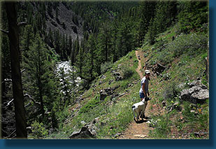
rocks in the water for Makenzie to retrieve. Up the switchbacks, we followed
the trail to a high point overlooking the creek, and a great view of the
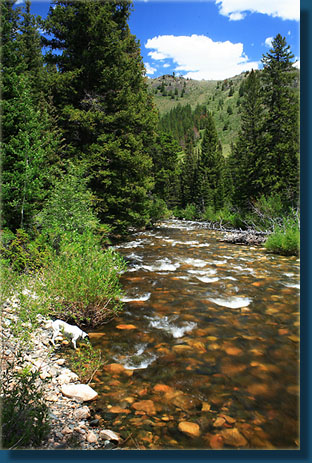
canyon and water. We hiked for another half hour or so to a point just
past the Tie Slide bridge where we stepped off the trail and relaxed for
about an hour, reading and napping in the cool shade with the relaxing
sound of gurgling water emanating from the swift current only 10 feet away.
I would estimate we hiked in about 2-3 miles from the parking lot. By 1:00
we were ready to roll on back to the car, and we made no stops on the way
back. We saw only three other people on the trail. When we arrived back
at the parking lot a little after 2:00, we opened the car windows to cool
it off and then walked down the creek to cool our feet in the creek and
swap our hiking boots for sandals before the drive home. The water in the
creek was very cold, but refreshing.
|
|