 |
 |
 |
 |
 |
 |
Prospect Mountain, Colorado
| Location: Roosevelt National Forest,
north-central Colorado
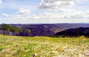
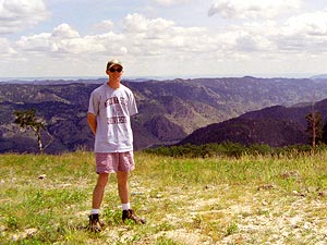
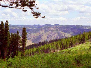
Maps: USGS 7.5' Quad: Rustic; Trails Illustrated 1:40K: Cache La Poudre/Big Thompson #101 Access: From Ted's Place on Hwy 287, follow Hwy 14 west for about 25 miles, south on Pingree Park Rd (CR 63E) for about 4 miles, west on Crown Point Rd for about 5 miles to the Mineral Spring Rd closure. Fees: None Trail: Route follows old logging road for about 1 mile to an abandoned mine and an open plateau with nice views to the north. Dog Regulations: Voice control Weather: Current and recent conditions Local forecast Dave and I hiked to the top of Prospect Mt in June of 1998. Prospect Mt is a short little affair located off the Crown Point Road overlooking Mineral Springs Gulch. The map shows a dirt road snaking all the way to the top, but it peters out for vehicle use long before that. I don't recall exactly where we parked, but the hike ended up being 1-2 miles along an old road that made for very simple walking. I remember it being a hot summer day, with lots of sun and a few fair wather cumulous clouds. The ease of the grade in the road made it a good conversational hike as neither of us found our breath at all impeded. The road to the top and the name of the mountain made us think that perhaps an abandoned mine was to be found, so we made that our goal of the afternoon. It wasn't tough to find, since we basically followed the old road to the front door. Unfortunately, the mine was caved in at the entrance, so all that was left was a lage pile of rubble in the side of a steep cut. I found a heavy chunk of what must be some sort of metal like lead, and have kept it, for some silly reason, to this day. |
|
|
|
|
|
|
|
|
|