| Location: Mirror Lake &
Comanche Peak, Rocky Mountain National Park, Colorado
Access: One way to get there is to head 53 miles west on Hwy 14 from Ted's Place and turn south on Long Draw Rd. Head south on Long Draw Rd almost to Long Draw Reservoir, and park at the well-marked Corral Park TH. Trailhead: NAD83 zone 13 434737e 4485531n Elev: 10,030' Trail: 6 miles and 1000' to Mirror Lake on a well-groomed trail, another 1.5 miles and 1700 feet to Comanche Peak across open tundra Maps: Trails Illustrated 1:40K Cameron Pass #112; USGS 1:24K Comanche Peak Dogs: As the trail enters Rocky Mt National Park, no dogs are allowed at all Fees: None. The trail begins in national forest, and there is no entrance booth or fee Weather: Current and recent conditions Local Forecast
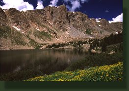
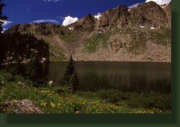
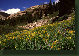
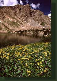
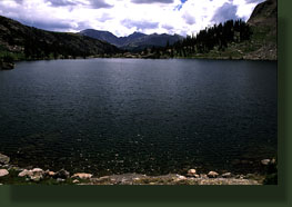
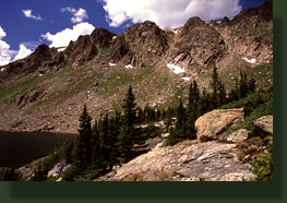
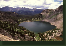
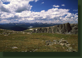
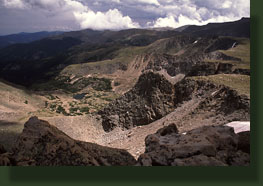
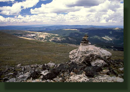
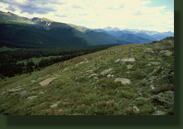
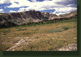
August 7, 2006 I left my house in Cheyenne at around 6AM, and drove east through the early morning light past Vedauwoo, past Laramie, south along the Laramie River past the Rawahs, across the Poudre Canyon highway, and south along the Long Draw Rd to the Corral Creek trailhead. It was overcast most of the drive, but I hoped the sun would come out. Blue sky was clearly visible to the east, and the clouds seemed to be receding to the west. It took 2 hours driving before I stepped out of the car in a small dirt parking lot 10,000 feet above sea level and about 1.5 miles north of Long Draw Reservoir. The indomitable smell of conifer forest filled the thin, cool air. I opened the trunk of the car and laced on my boots, put my water in my old blue backpack and slathered thick white sunscreen over exposed skin. Clouds or no, itís good to have a UV block, especially at altitude. Several cars were parked in the lot, but only one person was around: an old man seated in a chair by the information board. A volunteer? I don't know and I didn't stop to ask. I just nodded hello on my way down the short slope that brought the trail right alongside Corral Creek. The trail passed through a few open grassy areas on the banks of the chattering stream, but mostly it lead through tall, thick spruces. As the trail was generally downhill, I took this part of the trail very fast, actually tripping and falling forward over a tree root. I slowed down after that, though I still made rapid progress. I was nervous about those clouds, and having just come off a week where I had to turn back from the summit of Columbia due to lightening, I wanted to be sure to get up high and get back down before the stormy weather socked in. But the stormy weather was hours away yet, and the sun came out to warm up the cool mountain air and send encouraging slants of yellow light through the spruce boughs. I reached the fledgling Poudre River in a little over half an hour, where the trail turned south and crossed over La Poudre Pass Creek and followed the Poudre River for about half a mile before the trail split and I took the left fork which is the Mummy Pass Trail. Nothing like a good dramatic trail name. A wooden bridge aids crossing over the river's small and bustling current here, and I was thankful that I didnít have to try jumping over it. I passed an elderly couple out for a stroll, and talked briefly with them on my way by, and shortly after passed the Hague Creek backcountry camp, a nice little spot with plenty of trees and water. In the distance to the east I could see the bare rock mountain ridges above Mirror Lake, bathed in sunlight. Thatís what I like to see, lots of sunlight. For nearly 3 miles the Mummy Pass Trail lead me relentlessly higher through an unbroken forest of lodgepole pine and spruce. I was sweating heavily, and enjoying the physical exertion through such a beautiful and peaceful setting. As in most solid conifer forests, there was practically no sign of wildlife, and the air was intensely still and quiet. Aside from the elderly couple near the river, I saw nobody, and savored the solitude. During this time, the sun sank behind the stubborn cloud bank and I grew to believe it would remain cloudy for the remainder of my trip. After about 2 hours of hiking, I reached the junction with the Mirror Lake Trail, and turned north past the Koenig backcountry camp and steeply uphill towards the lake. I could see the cirque walls surrounding the lake long before I arrived at its shore. As I neared the lake, the valley narrowed, and the abundant moisture fed the roots of millions of daisies. When I arrived, I sat on the rocks lining the south shore and had some water and a sandwich before noting streaks of sunlight playing on the opposite shore. I set up my camera and was ready when the sunlight passed nearby. As I continued my lunch, I noted a shape on the rock mound beyond the lakeís north shore that looked like a man standing up, watching the lake. I watched for some time, and gradually became convinced that it was in fact a tree. This gave me the idea that maybe it would be worth hiking up to that spot myself. I walked around slowly to the eastern shore, and admired the explosion of daisies and indian paintbrush that filled the meadows near the water. I continued on around the lake and began to climb again on the north side of the lake to get a better vantage of the cirque valley. The sun came and went, but overall it was becoming more sunny all the time. I felt that familiar tug of exploration nudging me higher and higher off the trail, and I obliged. The climbing was steep, but not technically difficult, and before long I was on top of a solid rock bulge overlooking Mirror Lake and a shallow tarn to its north. Mirror Lake was glimmering in sunlight, while Hague's Peak to the south was still wrapped in clouds. I moved higher, and topped out on a point northeast of the lake. I studied my map and saw that I was not far from the top of the ridge that separates Mirror Lake from Emmaline Lake, a lake Iíve hiked to on a few occasions. I relished the idea of seeing it from above. Timing was an issue. I had told Andra I'd be home by 4, but as it was already near noon, I realized the only way I could make that mark is if I turned back right now. I decided that the day was too nice to turn back, and so I hiked east, first downhill, and then up the steepest part of the cirque, following a grassy crack in the rock like a ladder until the grade leveled off and I was high above treeline on a broad, flat ridge. As luck would have it, I came across an area of abundant water among large boulders, and filtered some water. The sun faded back behind the clouds at this point, and the wind picked up. I put on my warm weather gear and walked east until I arrived at the brink of the wall over Lake Emmaline, a wall one can clearly see from Wellington or along I-25 north of the Budweiser Plant. I looked down onto the Lake Emmaline spire, and the green waters of the lakes below, Iceburg and Emmaline. I followed the valley down with my eyes to the Cirque Meadow, and then beyond to Pingree Park, Colorado State's mountain campus. What struck me from this vantage point was how barren these alpine lakes are. There is virtually no vegetation anywhere near their shores, just rocks of all sizes. To the north lay Comanche Peak, not so much higher than I was, and I decided right then to climb to the top. The boulder field at the base of the summit was a little tricky, and I had to backtrack a couple of times around large dropoffs and slick boulders. The climb was not without challenge. I reached what I considered the top, and took a few photographs of the valley below. From Comanche Peak, you can also look down onto Comanche Reservoir and the bulk of the Comanche Peak Wilderness to the north. I tried to pick out Crown Point, but I couldn't be sure of which point it was. I have hiked to Brown's Lake before, but I could not see it from here. I made my way east to another point, almost as high as the first, and there I found a summit log which I read and signed, carefully holding the paper in the high wind. To the west I could see Long Draw Reservoir, and to the south, the lofty summits of the Mummy Range were shrouded in clouds. After several moments of enjoying the incomparable view, I headed down. I retraced my steps to the cliff over the Emmaline Spire, but then I diverged and continued south along the rim rather than back to Mirror Lake. This route allowed me to prolong the enjoyment of being so high above things, and the flat, tundra hiking was superb. To my left lay the Comanche Peak Wilderness of Roosevelt National Forest, and to the right lay Rocky Mountain National Park. I gradually veered away from the rim and headed southwest, hoping to intercept the Mirror Lake trail that showed up on the topographic map. The trail in this case is simply a route suggested by periodic rock cairns. There is no visible trail on the ground. In the distance I could see a large herd of elk, and so I hiked on the far side of the ridge so as not to spook them. When I felt I was very close, I slowly peeked over the ridge to behold close to 100 elk not more than 100 feet away. I was quickly spotted, and counter to my intentions, what followed was something of a slow stampede, with all the elk gathering in mass and heading west at first, then hooking around and passing in front of me again on their way towards Comanche Peak. They made a lot of noise. I watched them until they were lost in the brown tundra, and then continued on downhill. In the two pictures I manage to snap with my wide-angle lens, I counted 72 elk, with some of the herd out of view in a shallow depression. I stopped and had a snack on an outcrop affording a final view of Mirror Lake, then descended into the trees. The trail became distinct as it neared the Koenig backcountry camp. For the next several hours I slogged downhill through gray forest with tired feet, anticipating rain at any moment. The rain, thankfully, never came, and as I neared the Poudre again, the sun came out again. I took more frequent breaks, and sat for a long time on a piling of the bridge over the Poudre, watching the clear water ripple over smooth brown rocks. I encountered many people fishing the river and La Poudre Pass Creek as I slowly trudged back to the car. After 15 miles of hiking and 3000' elevation gain and loss, I was very tired, and very happy to see the car again and begin the drive home. The entire hike took about 9 hours, which put me home at around 7:00, only 3 hours late and in time for dinner. |
 |
|
Page created 1-9-08 Comments |