Location:
Southeast Oahu near Koko Crater
Map:
USGS 1:24K Koko Head
Access:
From the Hanauma Bay turnoff on Highway 72 (Kalanianaole Hwy), drive west
to the first big intersection (just prior to a big shopping center) and
go north on Lunalilo Home Rd. Turn left on Wailua St and cross over Kuapa
Pond. Take a right on Keahole St, then the first left on Kaluanui Rd. Follow
Kaluanui Rd uphill, without turning, to the end of the road. Park at the
end, noting a trail that leads into the wild beyond. A sign says no trespassing,
but I had no problems and there was an obvious, well-used trail. The land
appears to belong to Kamehameha Schools, which I intuit to mean that the
land is used to fund schools on the island in some way.
Trail:
~1 mile and 850 to the ridgetop overlooking the windward side.
Fees:
None
October
4, 2007
Taking directions
from my friends fiance, I drove my rental car to the spot where the trail
began and wondered if this was the right place. It didnt look like your
typical trailhead, and being in an upscale neighborhood, I felt a little
out of place in hiking boots. Nevertheless, I parked the car and started
up the trail that lead through open, scrubland. For all its reputation
as a lush, forested island, lots of the southern half of Oahu is practically
desert. The wide trail wound through brown grass and small shrubs and I
was quickly looking down on the rooftops of the houses I had parked near.
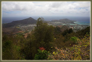
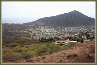
To the east, Koko Crater rose up, brown and rocky, and a little further
south I could see waves crashing in Haunama Bay. The sun was very hot,
and the lack of wind exacerbated the heat. It is one of the few hikes I
can recall on Oahu that wasnt wet and muddy, or actively raining. The
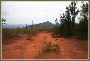
trail reached the spine of Kuluanui Ridge, and leveled off a bit on a wide,
hard-pan surface of red clay. Small ironwood trees grew here and there,
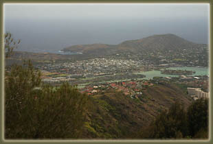
providing some shade. To the south I could see Maunaulua Bay and the slivers
of housing developments sprinting up into the hills, starkly contrasted
with the brown, rocky slopes around them. My face was dripping sweat, but
the short, 1-mile trail too less than half an hour to cover before I arrived
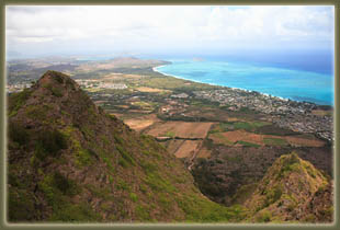
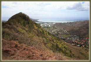
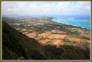
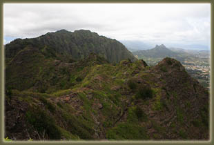
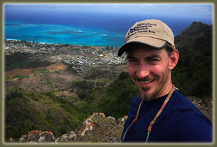
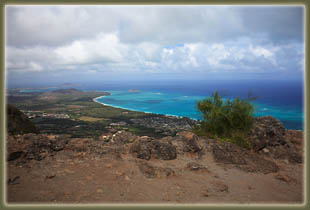
at the east-west ridge of the southern Koolau Range. A flat, beaten area
made a nice place to stop and enjoy the great view of the windward coast.
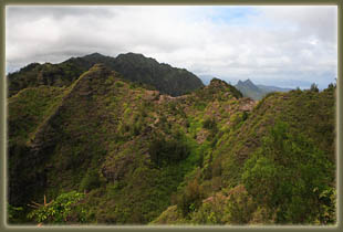
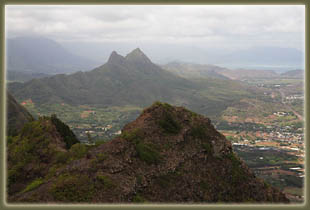
The jagged green ridge continued to the northwest, rising and falling with
steep slopes falling away in fluted cliffs and canyons. It looked possible
to continue on the ridge, but a little dangerous to try alone. The forked
summit of Olomana loomed large on the horizon. I tarried up top for quite
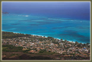
awhile, enjoying the area. From up high, I could see the arrangement of
reefs in Waimalano Bay, and again noted the stark contrast between the
housing developments and the jungle beyond. Vegetation was much more lush
on this side, as it gets the lions share of the rain. Plowed agricultural
fields of red soil lay in geometric patterns below. All very nice.
I hiked back
down and took a side trail halfway to the car that led to a bench surrounded
by a number of small trees, each with a plaque at its base honoring
a deceased US military serviceman. Small flags were stuck in the ground
beside each tree. I sat on the bench for awhile and rested from the heat,
then moved on. Got back to the car and drove off. Short hike, but with
a pleasant reward.
|
 |
;)
;)
;)
;)
;)
;)
;)
;)
;)
;)
;)
;)
;)