Hole in the
Mountain Peak, Nevada
August 3, 2009 I arrived near the trailhead the night before, after the sun had already sunk below the mountains to the west, hoping to camp near or at the trailhead. Not being able to reach the trailhead due to the rough road cancelled out plans of camping there, and the numerous cows milling about the grassy spot I parked at cancelled out camping altogether. Nothing like pitching a tent in cowshit! So, I flipped the backseats down and slept, sort of, in the back of the car, waking up in the middle of the night to see dark angus calves curiously sniffing my bumper. Ever had a cow watch you while you sleep? Kind of creepy. That, and the full moon and windy night prevented truly restful slumber. I was glad when 4AM rolled around. Enough of this lazing about! I got dressed, packed my bag, stretched my legs, ate breakfast and hit the road at 4:45, just as the sky to the east was getting bright. I could barely see the road, but what I could see convinced me that I’d made the right call stopping the car when I did. Even had I gotten past that first rough spot, 20 more, just as rough, lay in wait. The west wind whipped in my face, warm and dry, and I was soon sweating in my long-sleeve shirt. The rutted, rocky track of the road lead uphill, steeply, through sagebrush and desiccated, crinkled balsamroot leaves that rustled in the wind, and the sky grew red in the east. After 30 minutes of slogging uphill, I reached a clearing and the end of the road, what might be called a trailhead. No trail information was posted, and for a minute or two, I was at a loss of what to do next since there was no trail visible. Although shrubs had seriously overgrown it, I finally made out what could be considered a path heading west, uphill. I plowed into the shrubs, and got a nice leg-scratching along the way, as I followed a route uphill that I soon found was marked with a few cairns at odd intervals. Never did it seem like I was on anything more than a game trail. I lost the route a few times, but kept hiking uphill, anyway. It seemed like I should have been heading north since the only feasible route to the summit of the mountain was along the northern side of Lizzies Basin, but the cairns I found kept heading west, higher up above the basin below. Finally, the path and cairns turned north, and a steep, eroded path lead downhill through limber pines and aspen to the basin. I suppose the entire uphill jog from the trailhead was meant to avoid bushwhacking through neck-tall aspen. I plodded down towards Leach Creek, and decided that the trail looked to peter out at the creek. Thus, I bailed off and started heading northwest into the basin. It was easy going over grass and small shrubs with an occasional scramble up a rock ledge, and soon I was in the fairly-level area right in the middle, along swift-moving Leach Creek. The sun was above the mountains to the east, but a narrow band of thick clouds delayed sunrise by 15 minutes, which was fine since it gave me time to get further up into Lizzies Basin. Leach Creek ran down sloping white rocks, creating whitewater cascades and a nice roar of pounding water. I was surprised to find so much water up so high on what appeared to be very dry, craggy peaks. The map showed no lake or spring, so all this water had to be snowmelt. I hiked up steep hills of grass and lush growth near the stream to a nice point from which to enjoy the red light of sunrise on the beautiful cirque. High, sheer rock walls rose up from the basin, striated with gray bands and topped with crumbling, craggy pillars. A pinnacle of rock near the middle has a hole right through it, hence the name of the mountain. The basin was much wetter and lush than I expected, and I wound around taking pictures of the waterfalls, flowers and different views of the awesome cirque walls. I made my way to the north side of the basin, and dropped into a long, narrow drainage that runs almost ¾ of the way to the summit. If this section looks steep from a distance, it is. I was often using my hands to crawl up the 45-degree+ slope. Most of the rocks were solid, but there was quite a bit of loose stuff to slip on, so I took my time and tried not to get too impatient with the slow pace. A trickle of water intermittently appeared and disappeared. Lots of grass and forbs grew in this area most of the way up. In places it was so steep, I felt the need to firmly plant my knees on the ground before venturing a look behind and down the way I'd come. Towards the top of the drainage, things dried out and the going was tougher since everything was dry and loose. The soil was very crumbly and I had to sidehill more to stay upright. The nice bonus was that my early start meant I hiked this entire drainage before 7 AM, while it was still shaded from the sun, so it was not hot at all. Eventually I made it to a snowfield, and I ascended south of the snowfield into the boulderfield. The boulder field was a whole new challenge, and while I had huffed and puffed up the steep drainage, the challenge to the boulder field was not aerobic, but mental. It took constant focus to place each foot on rocks that wouldn’t flip and send me falling. Several times I’d step on a rock that would sway, but I managed to avoid slips or falls. Most of the rocks were, thankfully, well-seated. At one point I stopped to catch my breath and looked up to see a hairy white mountain goat staring quietly down at me from 20 feet above. When our eyes met, it soundlessly retreated behind the slight rise in the boulders, and though I quickly ascended to that spot, I didn’t see it again. Those are pretty cool mountain animals. As I scanned the boulder field looking for it in the rocks, I saw a number of animals running around and it took me a few seconds to realize what in the heck they were. I initially thought they might have been juvenile goats, but then one of them took off, and I realized I was watching several large Himalayan Snow Cocks, another introduced animal and a large bird that is about 2 feet long. The views from the boulderfield were great, since I was getting above the surrounding ridgeline and able to see far to the north and east. At a couple of points, I made my way south to the edge of the cliffs to look down, a long way. I didn’t stay near the cliffs too long. I plodded on up the boulders in the full sun, enjoying the blue sky, wondering when I might hit the summit. When it came at exactly 8:00, it was sudden. I poked over a big rock to a gentle tundra slope of scree and about 40 yards away sat a pile of rocks with a PVC summit log canister. Total time to summit was 3:15 from my car, 2:45 from the trailhead. I was the 4th person to sign the summit log in 2009. I should’ve checked to see how many 2008 entries there were, but did not. I spent about 45 minutes at the summit, taking pictures, making notes, eating, drinking and walking around enjoying the view. I walked south along the wide, flat ridge to see if there was access to the “hole” in the mountain. There is not, at least not any easy access. All cliffs and drop-offs. I see no way short of a class 5 climb to get to the hole from the summit, but perhaps if one were to approach from the west, up the drainage, it might be done. The way down was long and a little monotonous. Constant attention to what my feet were doing meant I had little time to look around and enjoy the scenery until I got back down to the relative flatness of the basin. I took more pictures, and spent more time sitting and soaking it in. The appeal of this basin is that there are no trails, no cairns beyond the first ½-mile, and no sign of human “improvements”. Just beautiful wilderness. Forest Service take note: we do not need trail building crews to visit this area. Leave it alone. As the sun rose higher and
the heat intensified, I made my way east out of the basin and back down
the access road to the car. Great hike!
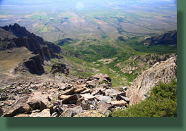
Looking back at the hike route from the boulder field 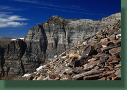
The imposing cirque wall from the boulder field 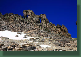
Very cool rock arches near the summit 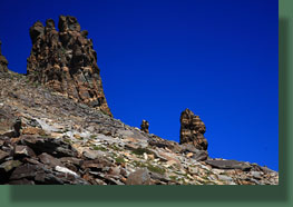
Rock pinnacles near the summit 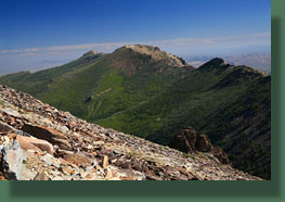
Greys Peak 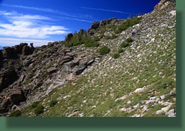
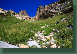
The chute up the north side of the basin 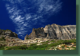
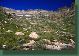
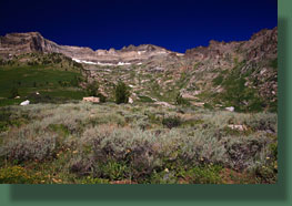
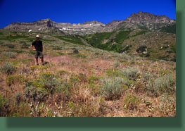
Back at the car after the hike |
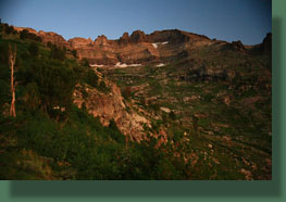
Pre-dawn in Lizzies Basin 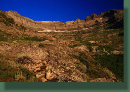
Looking up at Hole in the Mountain 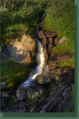
Leach Creek in Lizzies Basin 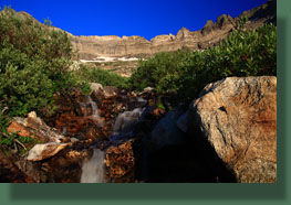
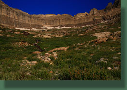
The Hole in the Mountain 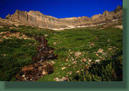
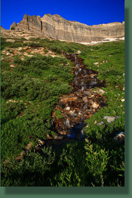
Falls along Leach Creek in Lizzies Basin 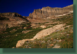
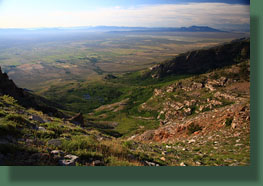
Looking down into Lizzies Basin from the north side of the basin 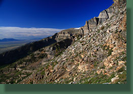
Looking south across the basin 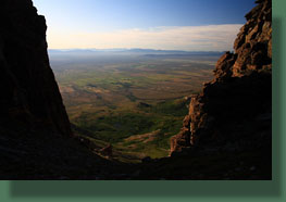
Access to the peak 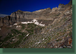
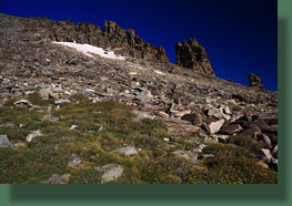
Into the boulder field 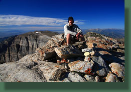
Ah, relaxing at the summit 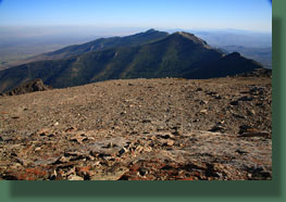
Greys Peak 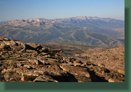
Ruby Mountains 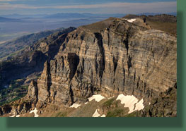
The cirque face 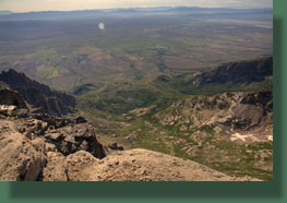
Lizzies Basin 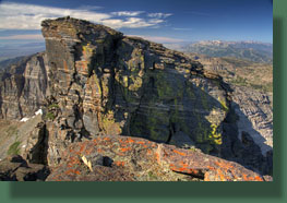
The notch near the Hole in the Mountain 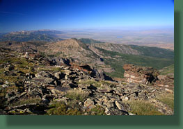
The west side of the peak 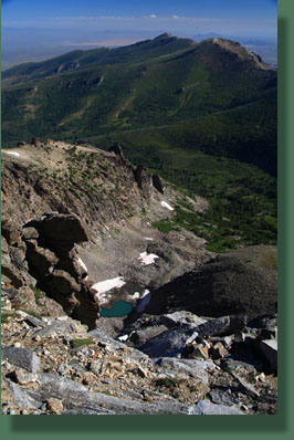
Unnamed tarn on the north side of Hole in the Mountain Peak, Greys Peak on the horizon |
