| Location:
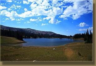
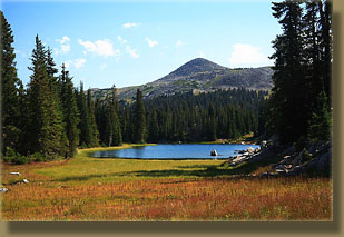
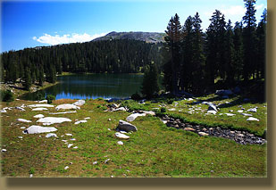
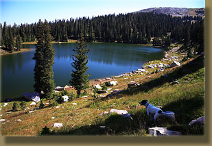
Heart Lake, Snowy Range, Medicine Bow National Forest, SW of Laramie, Wyoming
Access: Take highway 130 west from Laramie, past Centennial, and over the Snowy Range summit. After passing Lake Marie, be on the lookout for "Silver Lake Scenic Area". After you pass this sign, turn right on the first real road you come to, which will be in about 1.25 miles. Trailhead: NAD83 zone 13 387348e 4580389n Elev: 10,700' Maps: USGS 1:24K quad: Medicine Bow Peak (though my 1992 version is missing lots of roads) Trail: Unless you have a burly 4x4, plan on hiking at least 1.5-miles before reaching the trailhead. This is the steepest part of the hike, and once you reach the trailhead at Dipper Lake, the going is easy over mellow rolling tundra intermixed with spruce. Trail is faint in places, but itís hard to go too far astray. The Forest Service sign at the trailhead pronounces Heart Lake to be 1.7 miles, so for most this will mean a 6.4-mile round trip. Youíll probably end up parking at around 10,300 feet and hiking as high as 10,850 feet before descending to Heart Lake at 10,750 feet. Dogs: Voice control Fees: None Webcam: Arlington Interchange, 30 miles north Weather: Current & Recent Conditions Snow conditions NWS Forecast
August 26, 2007
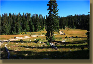
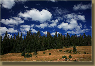
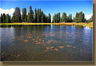
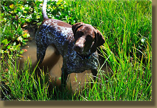
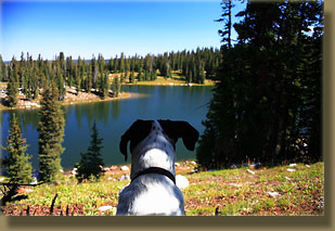
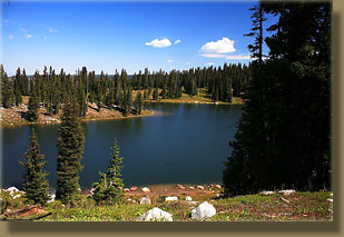
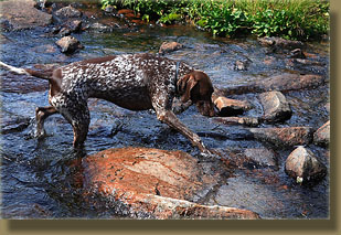
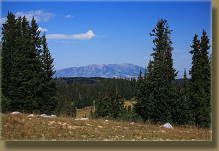
The road was in poor condition, so I went slow, but even that didnít prevent a few mammoth thunks of large rocks hitting the underside of the car. I passed a convoy of horse trailer, pickup and two ATVís just about to pull out onto the main road. I followed the road, confident of my mental map, for a mile before encountering a fork in the road that was not on my mental map. I pulled over and after reconnoitering my paper map, discovered it wasnít on there either. At this moment, the convoy passed me, and I decided to follow them. I gave them some space, and then pulled out onto the road. We all proceeded slowly up the mangled road and although the horse trailer made it through a deep mud-filled ditch, I decided to stop right there. I pulled off the road and got my gear together. I slathered some sunblock on, and corralled the frantic doggies and we were off up the road. I passed the horse trailer and company just around the corner. All the horses were being led out and saddled up. I cruised on by and noticed a sign reading FR 103. At least I was still on the right road. The road was shaded by some very large spruces, but I nevertheless grew a little warm hiking up the grade of the road. In no time, North Twin Lake was on my right. I believe that "Twin Lake" has got to be the most overused lake name in the US. They should start a program of renaming all these thousands of Twin Lakes across the US to something more interesting and, I donít know, unique. Every mountain range has a Twin Lake or two, sometimes there are two, sometimes more. The Snowy Range has at least 4 that Iím aware of. I crossed two streams, and then the road led into the open sunshine and it really got warm. I sipped water constantly, not wanting to have a headache all afternoon. Frank and Makenzie flitted about like bees, back and forth across the road. I was mildly nervous that an ATV would come ripping down the hill and squish a dog, but none came. I reached Dipper Lake (now thereís a nice, unique name!) and here the map showed the two-track I should take, which led between the big lake and small pond to the northwest. A jeep was parked near the lake with a large camp, but nobody seemed to be home. I walked past and shortly beyond came to the official trailhead, some 1.5 miles beyond where I parked my car. The trail started out definitively, and was clear for the first ½ mile or so before it petered out into the grass and I just followed the large rock cairns. This was obviously an old jeep road, and the tire ruts still persist. In less than mile, I came to the fork which leads to Medicine Bow Peak in 1.9 miles, or to Heart Lake in 1 mile. I turned north and headed for Heart Lake, vaguely entertaining notions of also heading up to Medicine Bow on the way back. The trail continued to lead through a nice mosaic of spruces and alpine tundra. All the flowers were spent, and seed pods rattled in the grass as the dogs skipped back and forth across the trail, furiously searching for the gophers that are responsible for the ten thousand soil mounds that are visible all along the trail. Just over an hour after leaving the car, I reached a meadow with no cairns and no obvious trail. I could tell by the gap of trees on the horizon where the lake was, but it still surprised me to find that the trail simply vanished. I walked due east and came out on a rim above the lake, right next to the feeder creek. Crossing the creek, I then hiked uphill into some trees overlooking the lake, and situated myself in a nice shady spot with a view. Shucking my boots off, I pulled out my book and attempted to read. Makenzie made this difficult as she kept bringing me rocks to throw. Itís a little fetch game she came up with when her tennis ball isnít around. I throw the rock into the brush, and she uses her uncanny sense of smell to retrieve it. I tried to ignore her for several minutes, but she kept picking the rock up and dropping it into my lap. I relented, and for the remainder of the hour, threw the rock at intervals of 30 seconds to 4 minutes, depending on how sneaky my throw was. Frank, meanwhile, waited in the sunlight for me to throw something for him also, which I obligingly did by tossing spruce cones to him. He chased them, destroyed them, and wagged his tail furiously. Dogs make even a rest break entertaining. After almost an hour of reading and tossing objects for the canines, I packed up and we all headed back down the trail. On the way back, the sky clouded over and a stiff wind picked up, cooling things off a great deal. I passed an old couple hiking in with fishing rods, and later a group of 6 people who apparently drove all the way to the trailhead in a pickup. I think walking would have been faster, but certainly to the car-loving American, not as much fun. I passed a pond on the jeep track that had ATV tracks through it, still visible by the dearth of vegetation in the thin parallel strips, back and forth across the pond bottom. I hear ATV groups claim that their members are all responsible riders and stay on trails, and that may be true for official members. Nevertheless, there are a lot of yokels out there who just seem to go stupidly crazy on an ATV, driving through ponds, wrecking wet dirt roads, distributing trash and filth, harassing wildlife or cows (whatever can be found), driving up trees, etc. etc. etc. Itís a sad fact, but show me an ATV trail and Iíll show you at least $1 of recyclable aluminum cans. In fact, I picked up two beer cans right where I parked my car. More than once Iíve carried a bag to pick up trash on a trail shared with ATVís and run out of room in my bag. Towards the spot where I parked, I encountered a group of about 10 horses out for a Dude-style ride with city-dressed folk riding the mounts. I hailed the doggies over to me off the side of the trail and we watched them pass by. By 12:30 we were back at the car, completing the round trip with reading break in about 3 hours. My nervousness about the fuel situation turned out to be unfounded, as I reached the Centennial gas station without the fuel light ever even coming on. No problem. |
 |

Page created 1-21-08
|