Fish Creek, Colorado
Location: Roosevelt NF, Comanche
Peak Wilderness, north central Colorado
Maps: USGS 7.5' Quads:
Rustic,
Pingree
Park; Trails Illustrated 1:100K:
Cameron Pass #112
Access: From Ted's Place at the Poudre Canyon entrance, drive
25.7 miles and turn left onto Pingree Park Rd (CR 63E). Drive south 7.7
miles to the trailhead which is right next to the S. Fork Poudre-CR intersection.
Trailhead: NAD83 zone 13 455503e 4496540n Elevation: 7910'
Fees: None
Trail: 6 miles, one-way. Elevation gain of around 1300
ft. Trail follows Fish Creek closely for most of the distance, and stays
in thick timber most of the time.
Dog Regulations: Voice Control in National Forest, leash control
mandated in wilderness.
Webcam: Pingree
Park 2 miles south (spring-fall only)
Weather: Current
and recent conditions Local
Forecast
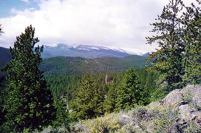
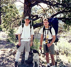
 Fish Creek is located near Commanche Peak. It flows from west to east through
a steep wooded valley in which it is quite difficult to locate flat ground
to camp on. Mark Elssaesser and I backpacked in about 3 miles in July of
1998, and of course, Frank joined us. The weather was great when we started
out from the trailhead, but less than an hour into the hike, it began to
look like serious rain was heading our way. We kept our eyes peeled for
any suitable ground to pitch a tent, and became anxious when we found absolutely
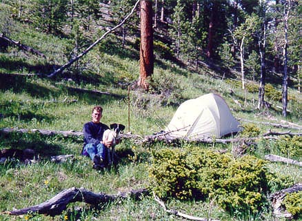
none. Soon it began to rain, and we stopped where we were and set up camp
on an uncomfortably sloping hillside. We set our tents up and napped through
the storm for a few hours. When the rain let up, it was dinnertime, and
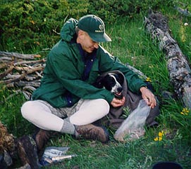
we ventured out into the wet grass to cook our dinner of red beans and
rice. Frank, being short of hair to warm himself with, was shaking miserably,
so I wrapped him up in his blanket and fed him
Fish Creek is located near Commanche Peak. It flows from west to east through
a steep wooded valley in which it is quite difficult to locate flat ground
to camp on. Mark Elssaesser and I backpacked in about 3 miles in July of
1998, and of course, Frank joined us. The weather was great when we started
out from the trailhead, but less than an hour into the hike, it began to
look like serious rain was heading our way. We kept our eyes peeled for
any suitable ground to pitch a tent, and became anxious when we found absolutely
none. Soon it began to rain, and we stopped where we were and set up camp
on an uncomfortably sloping hillside. We set our tents up and napped through
the storm for a few hours. When the rain let up, it was dinnertime, and
we ventured out into the wet grass to cook our dinner of red beans and
rice. Frank, being short of hair to warm himself with, was shaking miserably,
so I wrapped him up in his blanket and fed him 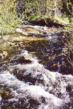 some
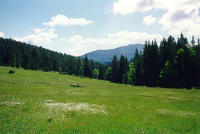
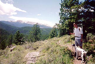
dogfood by the campfire. The sun came out after dinner and we went on a
short hike up the trail to see what lay beyond. We were relieved to find
we had not prematurely camped short of perfectly level ground, for the
trees became thicker and the hillsides steeper as we went along. Back at
camp, we stayed up until just past dark, then went to bed under the threat
of yet another storm. During the night, high winds strafed the area, and
I was quite sure my tent was due to collapse at any moment. The dome pinacle
of my tent, normally about 3 feet high, was at times bent down to within
inches of my face under the force of the wind. It got very cold that night,
and poor Frank suffered terribly I'm afraid. He just doesn't take to cold
too well. The next morning came without broken tents and we ate a filling
breakfast of pancakes and were off. Along the trail back, we discovered
evidence of the high winds the night before in the form of giant trees
felled across the trail which were not there the day before. This same
system was responsible for the Routt National Forest blowdown not far to
the northwest, where hundreds of acres of lodgepole pine were flattened
in one night. We got back to the van just before it began to rain again.
It just wasn't the best weather for camping.
some
dogfood by the campfire. The sun came out after dinner and we went on a
short hike up the trail to see what lay beyond. We were relieved to find
we had not prematurely camped short of perfectly level ground, for the
trees became thicker and the hillsides steeper as we went along. Back at
camp, we stayed up until just past dark, then went to bed under the threat
of yet another storm. During the night, high winds strafed the area, and
I was quite sure my tent was due to collapse at any moment. The dome pinacle
of my tent, normally about 3 feet high, was at times bent down to within
inches of my face under the force of the wind. It got very cold that night,
and poor Frank suffered terribly I'm afraid. He just doesn't take to cold
too well. The next morning came without broken tents and we ate a filling
breakfast of pancakes and were off. Along the trail back, we discovered
evidence of the high winds the night before in the form of giant trees
felled across the trail which were not there the day before. This same
system was responsible for the Routt National Forest blowdown not far to
the northwest, where hundreds of acres of lodgepole pine were flattened
in one night. We got back to the van just before it began to rain again.
It just wasn't the best weather for camping.
Back to Camping
Next
Page created 4-14-00
Last updated 1-2-02
Comments