| Location:
Grand Staircase-Escalante National Monument and Glen Canyon National Recreation
Area, Utah
Access: From Center x Main in Escalante, UT, drive 4.9 miles east on Highway 12 to Hole in the Rock Rd. Take Hole in the Rock Rd 16.5 miles and turn left on the signed road to Egypt Bench. Drive 9.6 miles (~40 minutes) over a road that is at times very rough (and may not always be passable to low clearance cars) to the trailhead. Maps: USGS 1:24K Egypt, Silver Falls Bench, Scorpion Gulch; Trails Illustrated 1:70K Canyons of the Escalante Fees: None (for now, hope it stays that way) Trails: Trails are not official and routes are not well-marked, sometimes not marked at all. Much travel is cross-country on your own. Itís easy to get off-track, so a map and compass are absolutely essential. On the other hand, steep canyon walls limit your ability to stray too far. Dogs: Officially, dogs must be leashed. Weather:Current and recent conditions Disclaimer: Part of the fun of exploring Escalante region is that you never quite know what to expect. I give away plenty of details in this account, so read on only if you really want to know what's out there. April 17, 2008
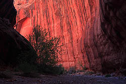
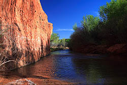
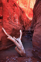
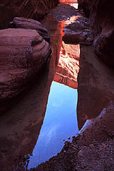
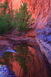
As it was only 3:30, I decided to explore the north fork of Fence Canyon, although it didnít look very inviting at first. A thick forest of Equisetum didnít beg to be explored, but I did anyway, plunging into the thick undergrowth and making a racket like no other animal on the mesa. I followed a faint path upstream that soon disappeared. No matter, the narrow canyon walls that stretched a hundred feet high allowed only one general route. I threaded a route through the willows, cottonwoods and equisetum, crossing the thin stream frequently, for about 45 minutes until I came at last to the box head of the canyon, an abrupt end marked by a solid rock wall rising up about 100 feet. A small pool of water silently reflected the red rock around it, and I stopped and rested on a cottonwood bent sideways from a spring flood long past (long past because even older shoots from the tree were growing vertically). I noticed with dismay that my feet were already hurting in the heels and two of my toes had blisters. I normally have neither problem, so I assumed it was my sneakers, which I had worn in lieu of boots because of the multiple anticipated river crossings to come. I took a few moments to apply moleskin to the hotspots, hoping that would solve the issue. I hiked back down Fence Canyon to the confluence
with the south fork, and found a place to camp nearby, stretching my hammock
between two cottonwoods and putting some gear inside. By that time my right
heel was giving me fits and I cursed my sneakers. Although I had worn them
to the gym, walking in the woods and even jogging, the extra weight of
the pack caused funny things to happen on my heels to make the shoes terribly
uncomfortable. I couldnít see spending the next 4 days hobbling around
like I had been, so as soon as the hammock was up, I began walking the
2.5-miles back to the car to fetch my boots (which I had luckily brought
just in case). The hike up had to be quick, since it was already 6:45.
I carried only essentials, and the cool air allowed me to keep a brisk
pace all the way so that I reached the car at 8:00. I changed into my boots,
and strapped the sneakers to my pack for the water crossings to come. I
briefly considered sleeping in the car, but it was still pretty light out
so I charged again downhill towards camp, with the sun already set. The
way back was easy to find since I had just hiked it twice, and the bright
moon that rose at sunset helped a lot. Still, by 9:00 I had to use my headlamp
to find a route down into the bottom of Fence canyon. I got to camp, slipped
off my boots (which felt infinitely better than the sneakers) and fell
into the hammock, falling asleep pretty quickly. It turned out to be much
colder than I had planned for, and I woke many times in the night from
the cold on one side of my body or the other. The hammock is convenient,
light, and very comfortable except it has no insulation at all, and even
with a down sleeping bag is not at all suitable for cold weather. I almost
left home without my Thermarest, but that turned out to be essential gear
as it provided a nice layer of insulation unerneath. In the morning, there
was ice in my water bottle. April in Escalante is not as warm as I remembered!
April 18
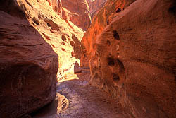
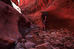
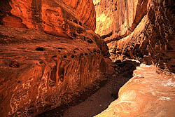
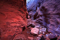
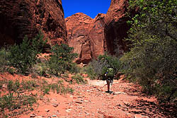
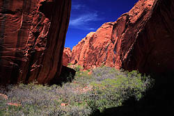
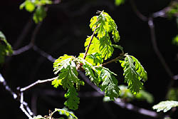
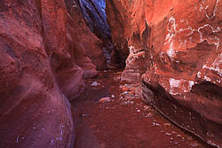
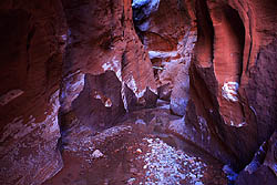
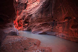
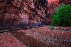
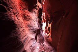
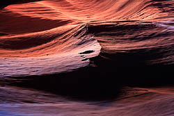
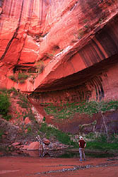
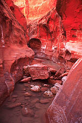
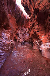
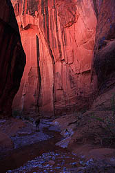
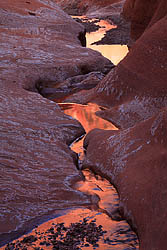
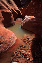
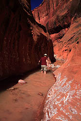
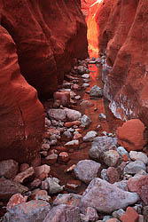
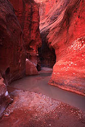
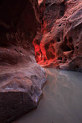
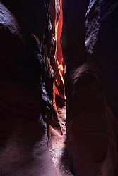
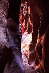
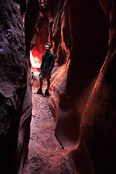
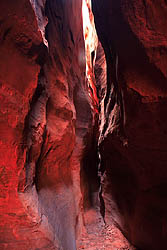
I walked for only about 20 minutes before I reached a point halfway between Fence and Choprock canyons, and decided the area looked right to make camp. I marched off into the cottonwood forest until I was well hidden from the path and found two trees to string the hammock between. Again, I loaded my non-essential gear into the hammock, slathered on some sunscreen, then headed up to Choprock with the just the essentials in my pack. A second crossing of the Escalante was required right at the mouth of Choprock, so I once again sloughed off my boots and donned my sneakers. I noticed a man standing at the mouth of Choprock canyon and waved; he waved back. I took to the water and waded as quickly as I could through the icy water upstream towards the canyon mouth. I got there and exchanged small talk with the man who was there. He was from Jackson, Wyo on an extended stay in the canyon, and camped at the mouth of Choprock. He gave me some pointers on the two forks of Choprock up ahead, which I knew absolutely nothing about beyond what the USGS map showed me. I thanked him as I finished changing shoes, and headed up the canyon. Choprock was wide and dry at first, with sparse groups of cottonwoods overlooking a chalky-white gravel streambed, but nice tall canyon walls of red Wingate sandstone that became progressively taller as I walked up the canyon. After several bends and almost a mile, I reached the first fork, and decided to take the north fork. The walls narrowed and the canyon deepened. There wasnít much vegetation at all in this section. After another few curves, a milky green pool of water appeared that blocked the way from wall to wall, a space of only about 10 feet by this point. The canyon curved 150 degrees here, so it was impossible to see how far the pool went on and how deep it got. I changed shoes and waded, sucking in my breath as the cold water, much colder than the river, hit my legs. My feet sank into slimy muck with each step and soon my shorts were getting wet, without any sign of the bottom leveling off. So I backed out, took everything out of my pockets and wrapped up my camera in my zipped-off pant legs inside my pack in case I should fall in (hey, every layer helps!). Then I waded back in, slowly, with one hand on the wall for balance. The water depth reached my thighs, my waist, my bellybutton and as I rounded the corner I could see dry land beyond. I breathed in shallow gasps at the coldness of the water, probably in the lower 40ís, and just when I was about to turn back, the next step was not so deep. I quickened my pace and walked out of the pool onto a spit of sand. The water had come up several inches above my bellybutton. There were more pools beyond, so I kept going, although none were as deep as the first. After the pools retreated to knee-depth, I pulled out my camera and photographed as I walked up the coolest narrow canyon Iíve ever had the pleasure of walking through. The canyon varied in width but at its narrowest it was no more than 3 feet wide. The air was only about 60F, and in my damp clothes I got pretty chilled. Whenever I reached a wider spot where sunshine came into the canyon I stopped and stood in the warmth. It was a pleasant walk. At times I could swear I heard voices either up ahead or behind, and a few minutes later be equally as sure that all I had heard was wind whistling around the stone curves and waves. Odd canyon acoustics. As all things must, the canyon narrows ended after about 2 miles and it widened out and reached a second fork. I again took the north fork into a wider, drier canyon filled with white oaks. I didnít go too far since I had gone very slowly through the narrows and the day was winding down. I took advantage of a clear pool of water and refilled my water bottles. My trip back was every bit as exciting as the trip up, though I wasnít looking forward to getting soaked to the chest again. No help for it. When I got to the pool I could see mud on a ledge where some had skirted the water (with or without success, itís unclear), but with my bulky pack, there was no way to attempt it, so I slogged back into the water, counting 32 cold steps to the other side. I bee-lined for sunshine and sat in it and had dinner of tuna and crackers while my shorts dried. Then, on down the canyon towards the river. In the main stem after the first large bend
in the canyon coming up from the river, there is a massive alcove that
had some kind of rack in it, perhaps for drying meat. A firepit and sitting
stones spoke to frequent stops by hikers and campers. Near the confluence
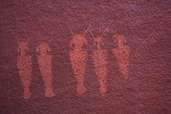
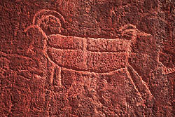
with the Escalante, I checked out a wall of petroglyphs on the north side
of Choprock about 1/8 mile from the river. I followed a faint footpath
right to it. Most of the inscriptions seemed to be from cowboys in the
1800ís, many with the Osmond family name, but there were also a few of
the weird, enigmatic figures common to Native American petroglyphs. What
do they represent? Were there really bipedal horned creatures roaming about
back then? Impossible to say. From there I waded the river again, and went
back to camp for a relaxing evening and a cold night in the canyon.
April 19
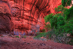
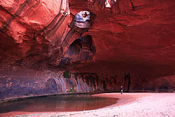
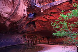
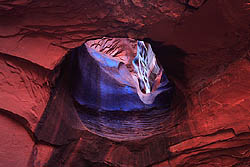
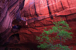
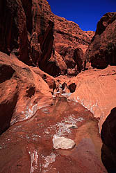
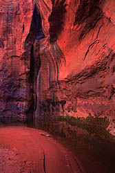
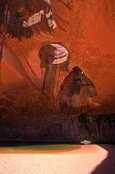
I retraced my steps all the way back to the mouth of Choprock Canyon without any trouble at all, literally following my own footsteps (the only ones) through the sand. It was about 4:00 when I returned to camp, which was earlier than I had anticipated. Rather than wait out the evening to spend the night there, I decided to pack up camp and head on down the river to something new. An hour and a half or so later I arrived at the entrance to Neon Canyon. The wind had kicked up to an extra vicious level, and blew sand in sheets up the narrow canyon. I had to constantly shut my eyes when I heard an approaching wave of airborne sand hissing through the canyon. There seemed to be no running water in the canyon, though several long pools hung on underneath towering tiger-striped walls. Cottonwoods and willows glowed green against the overall red landscape. I stashed my pack near the entrance and continued up the canyon with just my camera, remembering that I had read the twin bridge pouroff was not far up ahead, the dramatically-titled ďGolden CathedralĒ. I walked quickly, enjoying the solitude and the feeling that I was firmly alone in the canyon. Even in our relatively sparsely-populated country of 300-million, true solitude is so hard to find. I passed through lots of poison ivy, thankfully not yet leafed out, and hopped over several large boulders to come at last to a large alcove, undercut deeply on all sides with the fabled twin bridge pouroff on the upstream side, hanging quietly 40 feet above a still pool of water with ledges tapering off as they curved out around the edges of the alcove reminding me of wings of some large owl. The wind did not reach this far back in the canyon, and the quiet caused my ears to ring. I admired this geologic spectacle from all angles and snapped a few photos before heading back down the canyon. I grabbed my bag and hiked back to the Escalante
floodplain to find some cottonwoods where I could string my hammock. The
sky clouded up as I washed my face and arms in a collapsible bucket of
river water. For the first and only night of the trip, it did not get into
the 30ís, and I slept the whole night through very comfortably.
April 20
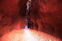
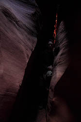
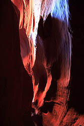
I hiked up Neon canyon as far as the first pool of water and filtered some for my bag. Then I walked back down to the mouth of Neon and headed downriver. There are 4 river crossings between Neon and Ringtail canyons and I took my time with each, drying my feet completely before putting my boots back on each time, usually indulging in a snack while I waited. I reached a couple of spots where the river seemed to be too deep and fast to cross without wetting my camera, so I had to poke around for easier crossings. The morning was calm and I didnít feel rushed to get anywhere in particular. Just me and the river, passing the time away. I encountered a few evil Russian Olives trees, always snagging at me with thorned branches like cranky old misers. Volunteers are systematically removing this awful invasive plant from the area, and my hat goes off to them for their efforts. Like most plants that are now quickly destroying native ecosystems, Russian Olive was purposefully brought to the US and planted enthusiastically by government agencies for windbreaks and wildlife habitat. When I reached Ringtail, I stashed my pack in the sagebrush near the canyon mouth and went in with only my camera. I didnít have far to go. The canyon starts off beautiful and narrow, and quickly gets narrower. In fact, itís more like a 2-foot wide cave. In most spots, you canít see the sky above because of the undulating rock walls. A flashlight would be useful here, although the darkness of the canyon is part of its appeal. Faint blue light seeped in from above, lighting some surfaces, but keeping others in complete blackness. Thatís a little disconcerting, but a quick pat of the wall where I couldnít see was reassuring. The floor was dry and sandy, and a cool breeze continuously flowed up the canyon. I followed the canyon carefully and slowly through the dim light, and it surprised me by how far it extended. At one point, I had to squeeze my chest through a spot only 11 inches wide. I reached a point where a chokestone had lodged in the canyon about chest level. I probably couldíve gone under it, but it looked like the walkable route petered out shortly beyond. Iíve never been claustrophobic, but the narrowness and darkness of this canyon gave me second thoughts. Itís hard to estimate because it curves a lot, but the walkable portion was about 100m long. I photographed the canyon as best I could with 30-second exposures and awkward tripod angles, relying on manual focus since it was too dark to use autofocus. Every portion of the canyon was extremely beautiful. I emerged after an hour into the sunlight and walked back to the river and retrieved my pack. I walked downstream in an effort to find a route up above Ringtail and perhaps drop down further upstream. I did find a possible route about 300m down river, but it was tricky, involving a jump that could go badly and since I was alone I couldnít afford to risk it. So, I turned back upstream and found a nice sunny spot to have lunch. Heading back to camp, I checked out a short side canyon on river right near Neon. It turned out to be pretty wide and uninteresting, but a nice diversion. Each crossing of the river had been cold and unpleasant in the morning, but in the heat of the afternoon I began to look forward to the crossings, and found myself walking slower and taking longer routes across the river each time. The cold water also had a pleasant numbing effect on my aching right heel, so I enjoyed it. As I neared Neon, I ran into the man I had met two days before at Choprock. He told me I had just passed a panel of petroglyphs and so I followed him back a ways to check them out. Many were so old the patina had covered them and made them almost impossible to see. Back at Neon, I hiked again to the twin bridge alcove where another fellow was photographing. Sunlight shone directly down through one of the openings and hit the undercut below. I snapped a few photos but the wind was swirling terribly and kicking up great clouds of sand. Within a few moments I was ready to go, and small talk with the fellow nearby continued as we both walked down the canyon together. He was from New York, recently laid-off and eager to take advantage of time off to see the west. Canít blame him. Iíll bet he never goes back. Near the mouth of the canyon we parted and I took a faint trail up the hill that led to a point above the river where I could see my hammock below. The trail then led northwest along the north side of Neon Canyon. This is the route canyoneers use to access Neon above the twin bridge. At that point in time I thought it was a hikable route down, but I was soon educated otherwise as I saw that you have to repel into Neon from above even at the easiest access point. My lack of repelling know-how foils yet another exploration! I contented myself to continue to walk along the canyon rim, enjoying it from above where it was wide enough to see into, and also enjoying the amazing horizon view of mesas, buttes and sandstone waves, all dotted with junipers and the occasional pinyon pine. Back in camp at 6:30, I attempted to find an advertised panel of petroglyphs that are located ďjust north of the entrance to NeonĒ. I searched the entire wall for ¼ mile and found nothing but millions of tamarisk branches to scratch hell out of my legs. I returned to my hammock, bathed the dust
and sweat away and enjoyed a relaxing dinner leaning against a cottonwood
in the 67F air. I noted gladly there were no bugs around at all.
April 21
Back to my pack at 10:30, and up the canyon.
I crossed the river several times in bright morning sunlight, my only company
being the ubiquitous little lizards that dart around the rocks every few
feet. I made it up to Fence Canyon in an hour where I pulled off my river-crossing
sneakers for the last time. From there it was a long, 2-hour hobble back
to the car across the windswept benchlands. My right heel hurt terribly,
and I stopped often to rest it, frustrated by the slow pace it caused me.
Something caught my eye, a bird or a butterfly. I glanced up to see an
F-16 jet shooting by not far above the ground, soundlessly. The roar of
the engine came well after he passed by. I arrived back at the car around
1:30, an hour later than I had planned, and indulged in a short feeding
frenzy of snacks and water from the car, and drove off towards the next
nightís camp, leaving only 2 cars at the trailhead.
|
|
