Upper Dadd
Gulch, Colorado
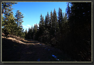
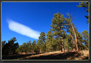
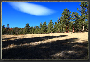
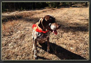
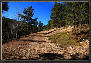
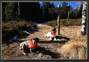
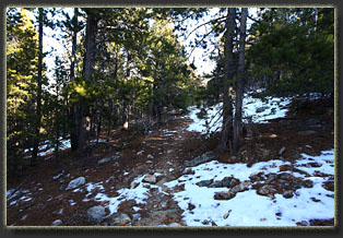
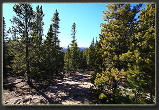
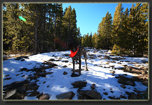
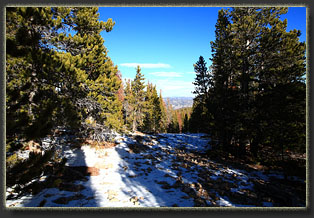
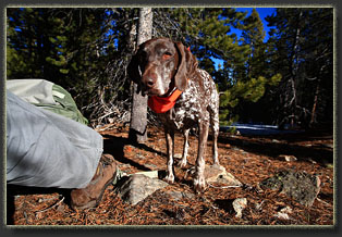
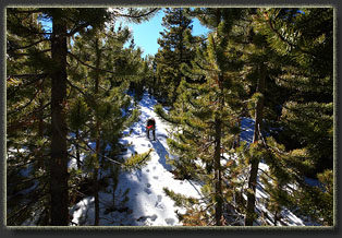
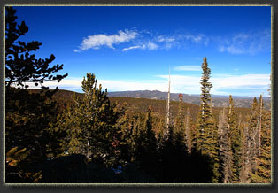
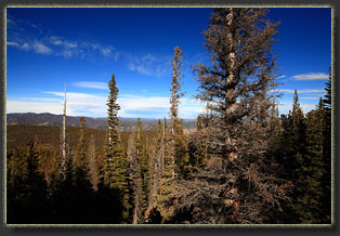
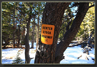
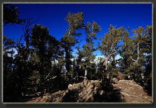
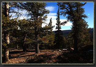
View Larger Map November 25, 2012 It’s 10:30 and I open the back door to let Makenzie and Henry spill out of the back seat, all slathering, panting and wagging tails. If possible, I think they enjoy hiking even more than I do. In the brisk 50-degree air, I swap shoes for boots, throw some orange bandanas around the dogs’ necks (is it still hunting season here?) and we’re off. The sun is near it’s daily zenith, but it’s so late in the year it barely tops the narrow spires of the giant somber spruce trees in the woods. Everything is slanted shadows and flickering sunlight in my eyes. We pass beyond the locked gate and head on uphill along an old road grade, which appears to have tire tread marks on it, though I thought the gate was always locked. The wind is brisk, but the sun is bright, and soon I shed my sweatshirt and am down to my long sleeve shirt, hat and gloves…on November 25 at 8500’…with almost no snow on the ground. This is Colorado, right? Makenzie and Henry zoom up ahead of me, turning around to check my slow human progress. Gosh, I must annoy them with my sluggish pace. A thought flickers through my head: is my pace the same as it was 10 years ago? Am I slowing down any? Such late-season hiking in the deep shadows and dry air conjures such thoughts. One never considers such things when the columbines are blooming, or when the sun glints off dew gathered on the feathery sepals of early-season pasqueflowers. It’s only in the cold air of winter when such sobering thoughts creep in. We plod on, enjoying the sights, the sounds, the smells. It’s all fun. Perhaps the most constant thing in all the world is the smell of the mountain forests, changing by season, but always distinct, as familiar as the smell of your grandparents’ house, only this smell will go on and on, long after grandparents, and you, are gone. The left side of the trail is a north-facing slope thick with spruce, fir and aspen. The right side of the trail is a south-facing slope, and is open, grassy and sprinkled with fire-scarred ponderosa pines whose alligator bark glows deep orange in the winter sunlight. The road steadily gains elevation, and at times I have to walk beside it when the dusting of snow in the two track ruts has been pressed to ice by a vehicle. The road is easy to follow. I cross a small creek and I’m in a clear cut, and the road ends near a large slash heap that looks ready to ignite. I scout around a bit among the short, vigorous spruces, but nothing looks promising. I return to the north side of the creek and look around, and spy a brown trailhead sign about 50 yards away. I corral the dogs in that direction and we hop on the narrow trail that immediately loses us in dense conifers, many of them dead and fallen, some blocking the trail. Within a hundred yards the grade gets very steep, and I pant along with the doggies, stumbling up the trail that at times seems more like a dry wash. The trail is not in good shape, very eroded and not marked, but without any snow on the ground I can follow the general route. After ¼ mile it levels out a little, and gains elevation at a steady pace as it follows the ridgeline through more spruce, fir, limber and lodgepole pine. I get peeks of snowy ridgelines to the south, but the low-angled sun makes it difficult to study the terrain in that direction. Snow blankets the trail with a few inches of white here and there, but mostly the ground is clear. At 12:30 I stop for a sandwich in a sunny spot just off the trail. Given the obvious lack of traffic, I hardly bother to leave the path to eat. Overhead the wind sluices through the tops of the pines, whooshing and whistling the soundtrack of delicious wilderness. A PBJ sandwich and granola bar hit the spot, and soon we’re heading uphill again, with a little more constant snow cover now. The wind is blustery, but it’s still not very cold. The trail is more difficult to follow under the few inches of snow. Occasionally I pass a yellow sign that says “Center Stock Driveway – US Forest Service”, but the signs are not posted frequently enough to help much in navigation. They simply confirm that I am on the path when I do see them. As we near the 10,000-foot mark, they occur with higher frequency and in fact do become very helpful as the route becomes vague and hard to find. There are several spots where I lose the trail entirely, and have to backtrack through the thin layer of snow to the last sign, and take a new direction until I find another sign. In places, the limber pine are so thick I can’t see from one sign to the next, and I have to guess a little about the direction of travel, looking for clues low branches chopped off of pine trunks or the unnaturally-smooth surface of a cross-cut log that perhaps once blocked the trail. I find myself relying on my map heavily to indicate which side of each little bump I should stick to; usually it is on the south. In order to return successfully, I stack up rock cairns in about a dozen spots where there is no snow to reveal my footprints. Ordinarily I’d have my GPS tracklog to help me out, but the cold air has drained the AA batteries and I neglected to pack extras. It seems more and more often these days I neglect to pack something important. Last time I went hiking, a short trip up in Wyoming, I clean forgot to pack a water bottle. Insanity. Anyways, not all is lost: Past experience has shown me that warming up the batteries in my pocket will squeeze a little extra life out them, so, I only pull the GPS out and catch a waypoint at key locations, slipping the batteries out each time and returning them to my warm pocket. At several of the high-points, a short trip off-trail delivers me to great viewpoints of the surrounding terrain, especially to the north where the sun is not in my face. It’s all terrain I’ve seen before, yet it’s no less fascinating now than it was 17 years ago when I first hiked these hills. Around 1:20 we descend from the last little pine-studded outcropping to Crown Point Rd, which is thick with snow and apparently impassable to anything but the beefiest of vehicles. The wind whistles overhead, and I feel infinitely confident that I’m the only human for at least 4 miles in any direction. There’s a pullout with a campfire ring just off the road, and one could as easily begin this hike from this location as from below, though there is no signage to indicate a trail begins here. With little fanfare, we about-face, and head back uphill for a stretch before beginning the long downhill traverse of the ridge. Travelling back is much easier because, of course, now I know the route. Also, the dogs know the route, and follow it so faithfully all I have to do is follow them. Makenzie is a German Shorthaired Pointer, which is a breed variously described as having significant Eurpoean bloodhound ancestry, and her nose is unfailing in the woods. I’ve sometimes followed her with my GPS on the way back to the car, letting her lead, watching our in-bound GPS track and marveling at how she will stick to that track to within a few feet for miles at a time, even going so far as to jump over a log at the exact spot we crossed it on the way in. I track my own footprints through the thin snow to be sure, and where there is no snow, I look for my cairns, or the yellow livestock signs. I end up not needing my GPS points at all. Hiking down steep, snowy-icy slopes is hard on the legs, since in such a case you always have to be tensed and ready for one of your feet to slip. It’s tiring, and especially on the rockier sections, my pace slows considerably. By 2:30 the sun is slanting very low through the trees and it begins to feel like evening, and like I should be getting back to my car. Contrast that with high summer when the pine bark smells like vanilla and the mosquitoes are biting the backs of your elbows and you’re on the trail and still feeling like there’s plenty of daylight at 6:30 in the evening! We pass a turnoff to the south marked with a cairn that has an enigmatic “Do Not Enter” sign laying on the ground nearby (447021e 4500169n). Otherwise the trail is unlabeled, but I believe it’s the route down to Beaver Park, and it drops steeply through the trees to the south. We make pretty good time heading downhDadd Gulch (Upper) Location: Roosevelt National
Forest, northern Colorado
November 25, 2012
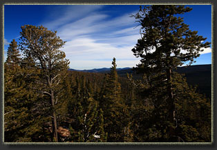
Makenzie and Henry zoom up ahead of me, turning around to check my slow human progress. Gosh, I must annoy them with my sluggish pace. A thought flickers through my head: is my pace the same as it was 10 years ago? Am I slowing down any? Such late-season hiking in the deep shadows and dry air conjures such thoughts. One never considers such things when the columbines are blooming, or when the sun glints off dew gathered on the feathery sepals of early-season pasqueflowers. It’s only in the cold air of winter when such sobering thoughts creep in. We plod on, enjoying the sights, the sounds, the smells. It’s all fun. Perhaps the most constant thing in all the world is the smell of the mountain forests, changing by season, but always distinct, as familiar as the smell of your grandparents’ house, only this smell will go on and on, long after grandparents, and you, are gone. The left side of the trail is a north-facing slope thick with spruce, fir and aspen. The right side of the trail is a south-facing slope, and is open, grassy and sprinkled with fire-scarred ponderosa pines whose alligator bark glows deep orange in the winter sunlight. The road steadily gains elevation, and at times I have to walk beside it when the dusting of snow in the two track ruts has been pressed to ice by a vehicle. The road is easy to follow. I cross a small creek and I’m in a clear cut, and the road ends near a large slash heap that looks ready to ignite. I scout around a bit among the short, vigorous spruces, but nothing looks promising. I return to the north side of the creek and look around, and spy a brown trailhead sign about 50 yards away. I corral the dogs in that direction and we hop on the narrow trail that immediately loses us in dense conifers, many of them dead and fallen, some blocking the trail. Within a hundred yards the grade gets very steep, and I pant along with the doggies, stumbling up the trail that at times seems more like a dry wash. The trail is not in good shape, very eroded and not marked, but without any snow on the ground I can follow the general route. After ¼ mile it levels out a little, and gains elevation at a steady pace as it follows the ridgeline through more spruce, fir, limber and lodgepole pine. I get peeks of snowy ridgelines to the south, but the low-angled sun makes it difficult to study the terrain in that direction. Snow blankets the trail with a few inches of white here and there, but mostly the ground is clear. At 12:30 I stop for a sandwich in a sunny spot just off the trail. Given the obvious lack of traffic, I hardly bother to leave the path to eat. Overhead the wind sluices through the tops of the pines, whooshing and whistling the soundtrack of delicious wilderness. A PBJ sandwich and granola bar hit the spot, and soon we’re heading uphill again, with a little more constant snow cover now. The wind is blustery, but it’s still not very cold. The trail is more difficult to follow under the few inches of snow. Occasionally I pass a yellow sign that says “Center Stock Driveway – US Forest Service”, but the signs are not posted frequently enough to help much in navigation. They simply confirm that I am on the path when I do see them. As we near the 10,000-foot mark, they occur with higher frequency and in fact do become very helpful as the route becomes vague and hard to find. There are several spots where I lose the trail entirely, and have to backtrack through the thin layer of snow to the last sign, and take a new direction until I find another sign. In places, the limber pine are so thick I can’t see from one sign to the next, and I have to guess a little about the direction of travel, looking for clues low branches chopped off of pine trunks or the unnaturally-smooth surface of a cross-cut log that perhaps once blocked the trail. I find myself relying on my map heavily to indicate which side of each little bump I should stick to; usually it is on the south. In order to return successfully, I stack up rock cairns in about a dozen spots where there is no snow to reveal my footprints. Ordinarily I’d have my GPS tracklog to help me out, but the cold air has drained the AA batteries and I neglected to pack extras. It seems more and more often these days I neglect to pack something important. Last time I went hiking, a short trip up in Wyoming, I clean forgot to pack a water bottle. Insanity. Anyways, not all is lost: Past experience has shown me that warming up the batteries in my pocket will squeeze a little extra life out them, so, I only pull the GPS out and catch a waypoint at key locations, slipping the batteries out each time and returning them to my warm pocket. At several of the high-points, a short trip off-trail delivers me to great viewpoints of the surrounding terrain, especially to the north where the sun is not in my face. It’s all terrain I’ve seen before, yet it’s no less fascinating now than it was 17 years ago when I first hiked these hills. Around 1:20 we descend from
the last little pine-studded outcropping to Crown Point Rd, which is thick
with snow and apparently impassable to anything but the beefiest of vehicles.
The wind whistles overhead, and I feel infinitely confident that I’m the
only human for at least 4 miles in any direction. There’s a pullout with
a campfire ring just off the road, and one could as easily begin this hike
from this location as from below, though there is no signage to indicate
a trail begins here.
 |
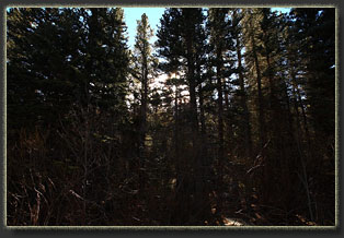
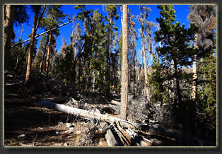
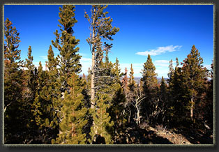
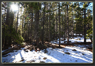
Deep woods near the beginning of the trail
|
